41 Miles / 2200 Feet of Climbing
Challenge yourself on a brutal 1,000-foot climb or simply enjoy an easy ride past scenic farm country. Either way, this route delivers a great experience straight out of downtown Scottsboro!
Potential Route Modifications: By skipping the climb and simply turning around at mile 17, this route can be made into a relatively easy 34-mile out & back with only 900 feet of climbing. By turning around at mile 9, you can skip all of the hills (big & small) and make it an 18-mile out & back with only 350 feet of climbing.
PLEASE NOTE: The CR 17 descent on this route is closed for construction until spring/summer 2021.
This route is billed as a challenge because of the 1,000 foot climb up CR 8, but it can also be made into a relatively easy out & back ride by turning around at mile 17 and skipping the big climb. There are a couple of smaller climbs on the first half of the ride, but nothing like the big one at mile 17!
We recommend starting the ride from downtown Scottsboro. There's plenty of free parking around the courthouse square, and the courthouse has restrooms that are open to the public. There are also several restaurants on the square that are perfect for post-ride recovery, like Payne's Sandwich Shop & Soda Fountain which is over 150 years old!
Because of the one-way streets, you'll need to exit the courthouse square on Peachtree Street. A few blocks later Peachtree Street ends at an intersection with South Street where you'll turn right. Take your very next left, which is Laurel Street and follow it until you reach its intersection with Cedar Hill Drive. Take a right on Cedar Hill Drive and you will immediately be at a traffic light at the intersection of Cedar Hill and Willow Street, which is the main road running through town.
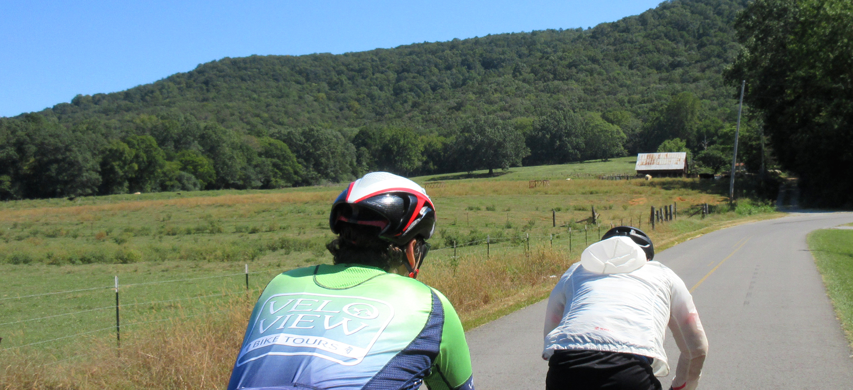
Take a left onto Willow as you pass through the light and stay on the shoulder as much as you can. This is a busy road, but you'll only be on it for less than half a mile before taking a right onto Old Larkinsville Road.
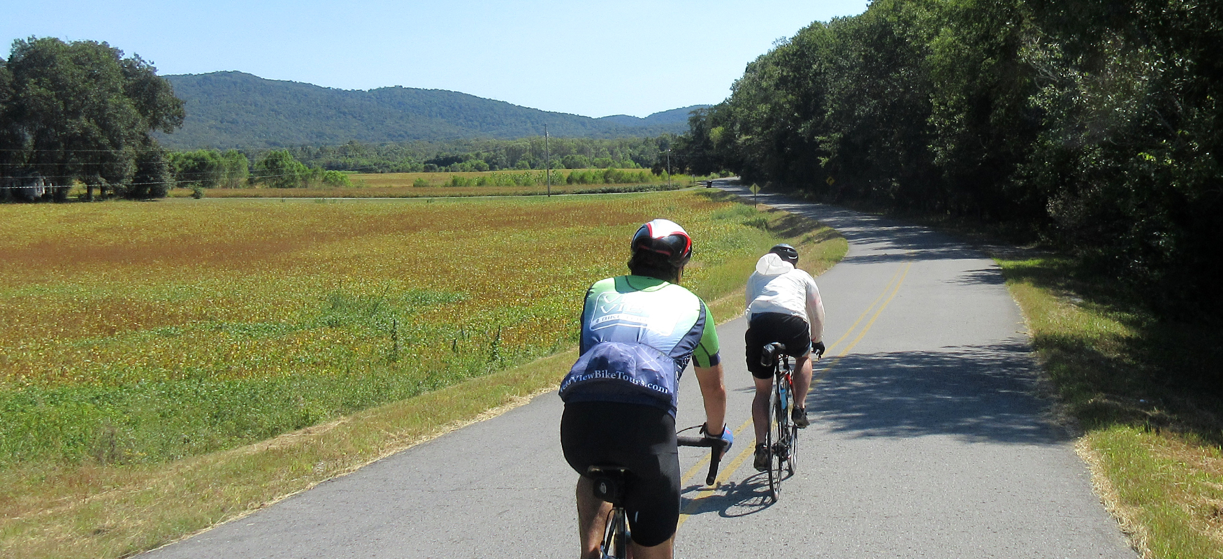
From here on out traffic should be relatively light. Use caution crossing the railroad tracks after turning onto Old Larkinsville Road and follow it as it bends around to the left and heads into wide open farmland.
Around four and a half miles after turning onto Old Larkinsville Road, you'll come to an intersection with Hwy 79. Carefully cross the highway and continue straight onto what will now be Larkinsville Road (with noticeably bumpier pavement).
A little over a mile later you'll come to a residential area. That's your cue to look for Harvey Wilborn Street. Turn right onto Harvey Wilborn Street and follow it past a few houses and a church. Once you pass the church, the road will once again become Larkinsville Road (with better pavement).
After leaving the residential area, the scenery will return to beautiful farmland, and, with the exception of a few short wooded sections, will remain like this all the way to mile 17. It will also be flat for the most part, with a few short, steep hills around mile 9.5 and mile 13.
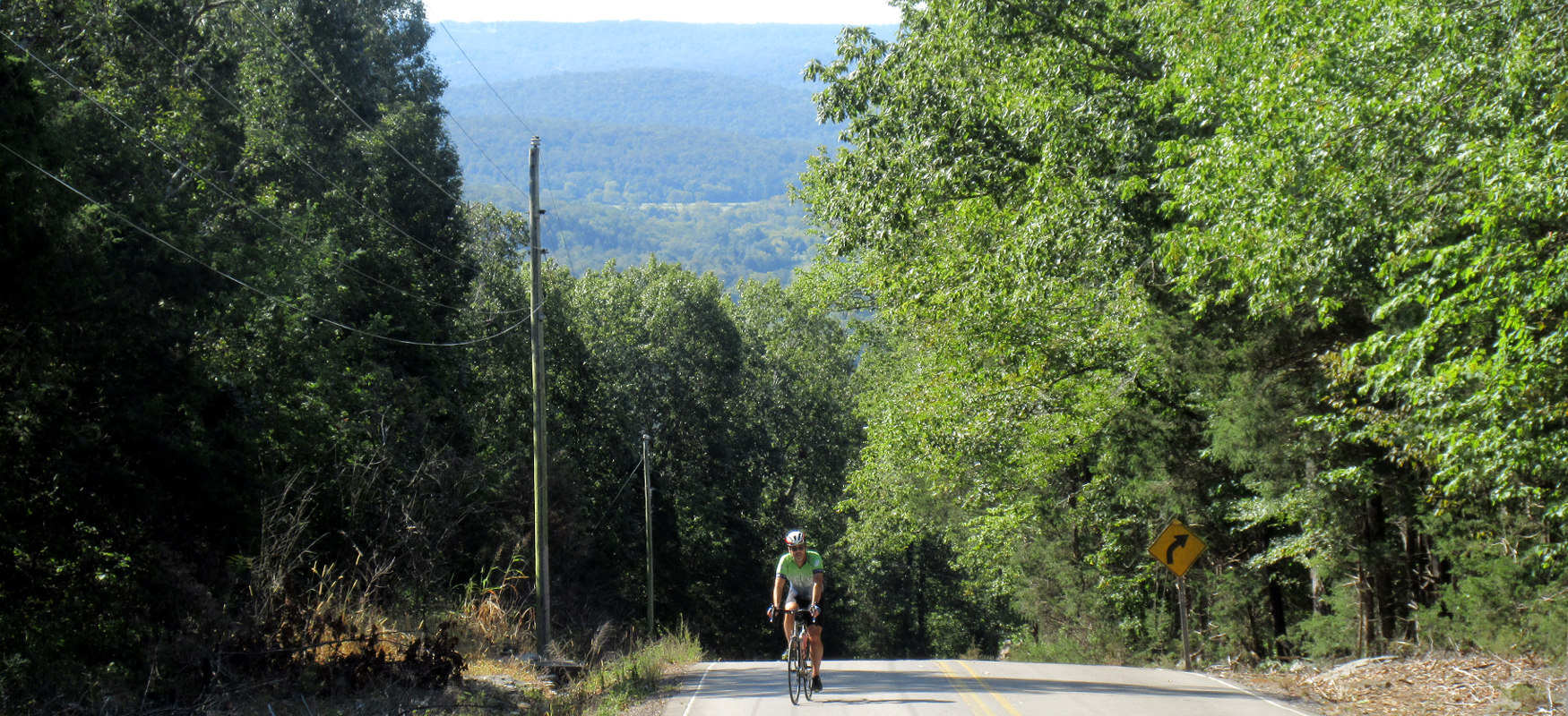
At mile 17, the road ends at a "T" intersection with County Road 8. If you don't like climbing, this is the point where you should turn around and return to Scottsboro. However, if you're up for a challenge, take a right on CR 8 and be ready to head uphill!
The climb starts almost immediately after turning onto CR 8, although the grades are pretty manageable early on in the climb, mostly in the 6-8% range. Don't get too comfortable though because the climb gets steeper the farther you go, and soon you'll be battling grades well into the teens! The one consolation for the added suffering is that the climb becomes increasingly wooded the higher you go. As the grades increase, so does the shade!
Traffic should be light on the climb, but you should still stay to the right of the road and try to avoid too much weaving, especially on the switchbacks and blind corners. You should be able to hear vehicles approaching from either direction, but it's always best to err on the side of caution.
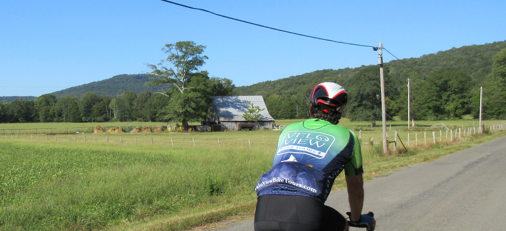
After a little over two miles, the suffering will end and you'll begin a fun roller coaster ride across the top of the ridge. You'll continue on CR 8 for the next 9 miles, passing by a mix of rural residences, open farms and wooded sections. It's a nice ride that will feel relatively easy (rollers notwithstanding) after dealing with the big climb.
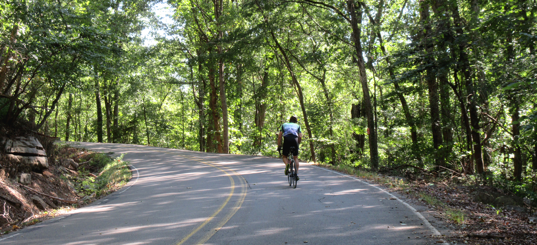
Around mile 28, take a right onto CR 15. A mile later, CR 15 will end at an intersection with CR 17. Turn right onto CR 17 and say goodbye to the ridge. A little over a mile later you'll be dropping down a descent that will last almost 3 miles! There are a few steep sections, but for the most part the descent is easy and manageable and just pure joy!
Shortly after bottoming out, CR 17 comes to a "T" intersection with Harvey Wilborn Street. Take a left onto Harvey Wilborn and you'll start to retrace your way back to Scottsboro, rolling past the same houses you passed earlier in the ride until you come to a stop sign at Larkinsville Road. Turn left onto Larkinsville and things should look familiar as you pass through the intersection of Hwy 79 and onto Old Larkinsville Road.
The only tricky part of the return ride is when Old Larkinsville Road ends at Willow Street. As you may recall from the beginning of the ride, Willow is a busy road, so you will need to use extra caution as you turn left onto it. You'll only be on it for half a mile before turning right onto Cedar Hill Drive, but it can be a little intimidating if you hit it at a busy time of day. Just hold your line steady and watch the driveways for vehicles coming & going, especially as you pass by Unclaimed Baggage. (Make a note of this place, as you might want to check it out after the ride. They have an unbelievable variety of goods in there that literally comes from unclaimed airline baggage!)
After turning right onto Cedar Hill, take your first left onto Laurel Street and follow it back to the courthouse square where you can wind down and refuel at one of the homegrown downtown restaurants!