34 Miles / 1900 Feet of Climbing
Enjoy a great mix of wooded and wide open roads as you ride through the Chickamauga Battlefield to reach the beautiful backroads of Catoosa County!
Potential Route Modifications: This route is essentially a series of loops, which means it can be modified in multiple ways by skipping one or more of the loops. Skipping the Davis Ridge/Potts loop (by turning right on Three Notch Road at mile 7) will reduce the route by almost 8 miles and 650 feet of climbing, including one of the hardest climbs. If you want to skip the big climbs altogether, turn right at Burning Bush Road off of Alexander Bridge Road and just do the Mag Williams loop. This makes the route a relatively easy 16.5 miles with only 650 of climbing total. If you're short on time or energy when finishing the ride, skip the battlefield tour (Jays MIll/Brotherton/Glenn-Kelly) and just follow Alexander Bridge Road all the way back to Lafayette Road. This will reduce the route by 2.5 miles.
If you're looking for a ride with a lot of variety, along with multiple options for distance and challenge, this is the route for you!
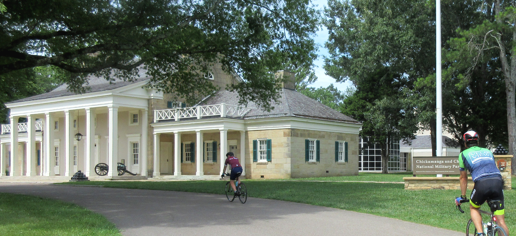
While many cyclists choose to start their rides at the Chickamauga Battlefield Visitors Center (which has public restrooms and good information about the battlefield), we recommend starting just up the street in the parking lot of Battlefield Outdoors and Park Place Restaurant. Making that your start/finish gives you direct access to any bike supplies or adjustments you might need, and it sets you up to enjoy a great meal when you finish your ride!
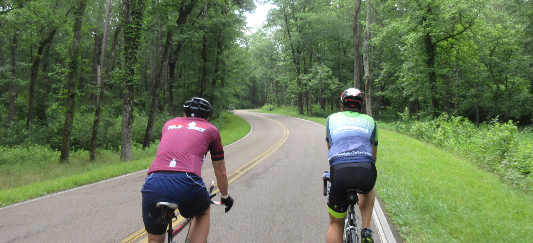
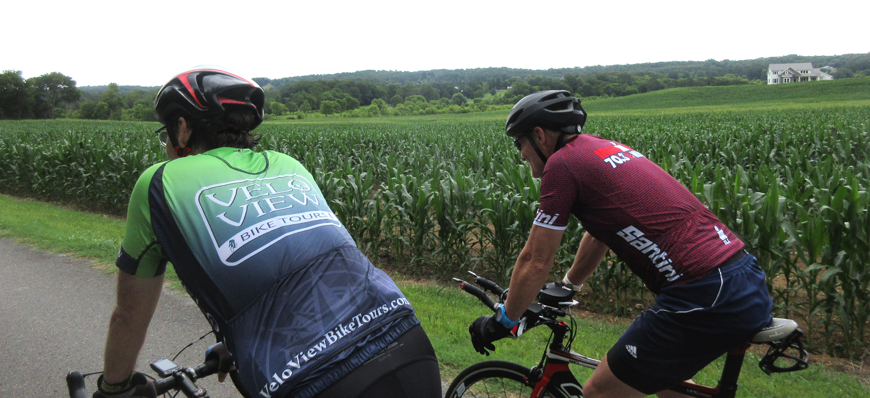
From that parking lot, ride out behind Battlefield Outdoors onto Martin Road and turn right. Follow this residential street down to Harker Road and turn right again. This will take you to a traffic light at Lafayette Road, where you'll turn left. Continue straight on Lafayette Road through the light at Reed's Bridge Road to enter the Chickamauga Battlefield. After you cross Reed's Bridge Road, you'll see the visitors center immediately on your right. After a quick stop at the visitors center, continue on Lafayette Road and take your first left onto Alexander Bridge Road and follow this peaceful tree-lined road roughly three and a half miles until you come to a stop sign at Burning Bush Road. Turn left onto Burning Bush Road and then immediately take a right onto Poplar Springs Road. As you make this little jog, be sure to look to your left. There's a nice view over an expansive cornfield with Lookout Mountain in the distance.
After turning onto Poplar Springs Road, you'll start to head uphill so shift down and be ready to climb. The climb is only half a mile, but it's quite steep and should not be taken lightly. After cresting the climb, you'll drop down to a stop sign at Post Oak Road where you'll turn right and then left in order to continue on Poplar Springs Road. This part of Poplar Springs Road may feel busier than the first section, as you will be entering a school zone. After passing Heritage Middle School, turn right onto Talley Circle and follow this residential street a half mile to a stop sign at Three Notches Road.
Continue straight across Three Notches and the street name will change to Davis Ridge Road. As the name implies, there's a ridge to be crossed on this road, and you will soon be heading uphill. This climb is a little longer than Poplar Springs and equally as steep, so gear down and be ready for the effort!
While there is some relief after cresting the top, there are still some rollers to contend with after the main climb, and then when you do start to really head downhill you hit another stop sign. Sorry for the tease! This one is at Mt Pisgah Road, which is a busier road than the neighborhood streets you've been riding up to this point. So be careful as you turn right onto it. While there may be a few more cars, the good news is that you finally get a sustained descent - a full mile of straight downhill bliss!
As the road starts to level out, it will bend to the right. Look for a little bridge on the right and turn right here. This is Potts Road, and unfortunately it's the start of another climb. The grade isn't too bad though, and there are some nice views off to the left. After a half-mile of climbing, the road will turn into more of a roller coaster with some fun fast downhills mixed in with some short climbs. It's a fun stretch of road that will eventually bring you back to Davis Ridge Road, where you'll turn left and follow it back to Three Notches Road.
Three Notches Road can be busy at times, so use caution as you turn left onto it. You'll only be on it for a mile and you'll have a shoulder for a short part of it, which you can use to let any vehicles pass if you have some stacked up behind you. After a mile, turn left onto Old Three Notches Road and follow this residential street a couple of miles before turning right onto Mel Daniels Road.
Mel Daniels Road is a great road that has a real rural feel to it. After a mile on this beautiful road, you'll be back at Three Notches Road, where you'll turn right. Half a mile later turn left onto Post Oak Road. Post Oak has a couple of little dips where you can pick up some speed, and it will eventually bring you back to Poplar Springs Road.
After turning left onto Poplar Springs Road, you'll be greeted with a tough half-mile climb. The descent on the other side is fast and fun, but watch your speed coming down, as it ends abruptly at a stop sign!
At the stop sign, turn left and ride on Burning Bush Road for a little over two miles until you come to a four-way stop. (Burning Bush Road may have a few cars on it, so hold your line steady and enjoy the scenery off to the right.) At the four-way stop, turn right onto Red Belt Road and then take your first right a half-mile later onto Mag Williams Road.
Mag Williams is another great rural road with good scenery and little traffic. After two and a half miles on this pleasant road, you will be back at Alexander Bridge Road, where you'll turn left and head back towards the battlefield.
Rather than following Alexander Bridge all the way back to the start, turn right onto Jays Mill Road (which is about a mile after leaving Mag Williams Road). Jays Mill Road may not have a street sign, but it is the only road intersecting on the right side of Alexander Bridge Road.
Jays Mill Road will feel like an oversized bike path with smooth pavement and a wonderful tree canopy overhead. After a mile, take a left on Brotherton Road, which is another stellar road that cuts through the wooded part of the battlefield. Continue straight on Brotherton when you get to the intersection with Alexander Bridge Road and follow it all the way to Lafayette Road.
Turn right onto Lafayette Road and then immediately turn left onto Dyer Road. (Lafayette Road is the main road through the park, so use caution as you make this little jog.) About a quarter-mile later, turn right onto Glenn-Kelly Road and follow it a mile and a half until it ends at Lafayette Road. Unlike the other battlefield roads you've been riding, Glenn-Kelly Road is not completely wooded and has a section with an open field where you can see the South Carolina monument in the distance.
After reaching Lafayette Road, turn left and follow it straight past the traffic light at Reed's Bridge Road before turning right at the next traffic light, which is Harker Road. Take you first left onto Martin Street which will take you back to the parking lot of Battlefield Outdoors and Park Place Restaurant where you can refuel after the ride!