31 Miles / 2900 Feet of Climbing
With big climbs, big views, and a fast descent, this ride has all the ingredients for an epic day on the bike conquering Chattanooga's iconic backdrop - Lookout Mountain!
Potential Route Modifications: Skipping the trip over to Lookout Mountain Flight Park reduces the total mileage by a little over 8 miles and shaves off around 800 feet of climbing. (We recommend against taking this shorter option though, as the trip to the Flight Park is well worth the extra effort!)
PLEASE NOTE: This route is for advanced cyclists. The climbing is very challenging, and the descending is technical in places. There are also some sections along the route that will have traffic. Do not attempt this route if you are uncomfortable with steep climbs, fast descents, or riding with traffic.
There are plenty of places to start this ride, but we recommend starting at the bottom so that the descent down the front of the mountain comes as a sweet reward at the end of the ride. We've mapped the route from Treetop Hideaways, which is one of the coolest places you can stay in the Chattanooga region. These are literally treehouses! Highly recommended.
Treetop Hideaways is right on Chattanooga Valley Road, which you'll take south (running parallel to the base of Lookout Mountain) for three and a half miles until you come to a stop sign. (There's a Dollar General at this intersection, which also makes for a good place to start if you're not staying at Treetop Hideaways.) Take a left at the stop and you'll almost immediately run into 193. This is a busy road, so use caution as you go straight across and proceed onto Chickamauga Road.
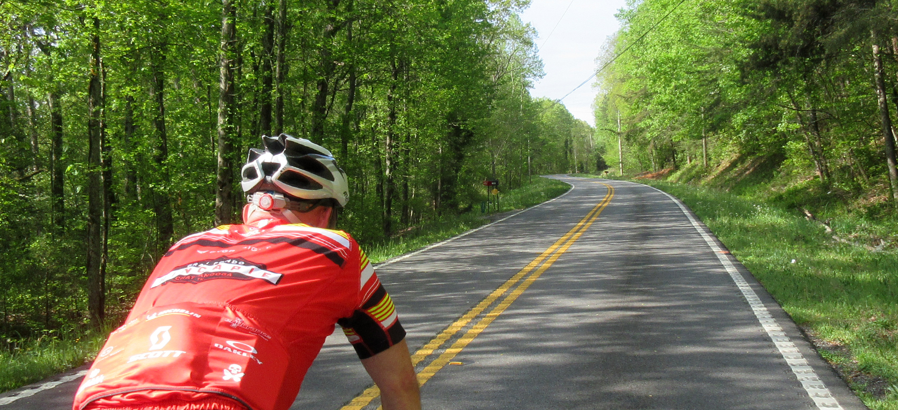
This next stretch of road may also have a few cars, so stay to the right and ride single file. After a mile on Chickamauga Road, veer to your right onto Old Chattanooga Valley Road, and then take your first right onto Nickajack Lane. Nickajack Lane will turn you perpendicular to Lookout Mountain and have you riding straight towards the mountain, which gives you a nice view - along with a sense of the challenge ahead!
After a quarter-mile of downhill, Nickajack Lane brings back to 193, where you will once again carefully go straight across and proceed onto what is now called Nickajack Road. At this point, the road will start to go up. It's not much of a grade at first, but you will notice it. This is just a warm-up for the real thing, and after little more than a quarter-mile, it will level off and even go downhill for a bit. The short downhill is your cue that the real climb is about to start!
The next half-mile is a tough section with grades in the double-digits the whole way. You'll get a little relief and some nice views off to your left after this section, but you'll still be pushing hard. That's when the real fun starts. Brace for grades in the high teens as the road makes a sharp righthand bend, and try to hang on for the next quarter-mile of pain! The road makes a sharp lefthand bend after this section, and you will finally be through the hardest part. The subsequent downhill section, though short-lived, will give you a chance to catch your breath before taking on the last short bit of climbing before Nickajack Road ends at a stop sign at 157.
While the climbing may be steep, please do not weave across the road to try to cut the grade. Nickajack Road will have some traffic, so you will want to climb on the right side of the road and be predictable in holding your line.
With the big climb of the day behind you, you'll now be able to enjoy some rollercoaster roads as you cross from the east side of Lookout Mountain to the west side. At the stop sign at the end of Nickajack Road, take a right and then immediately turn left onto Vulcan Road, which will have you winding through some rural farmland and wooded areas. Use caution on the descents, as they can be fast with a number of blind curves.
After a couple of miles, Vulcan comes to an end at stop sign with Mt Olive Road, where you'll turn left. Mt Olive runs for about a mile and half (most of it uphill) before ending at a stop sign with 193, also known as Scenic Highway. Be careful as you take a left onto Scenic Highway, as traffic may be moving fast on this road.
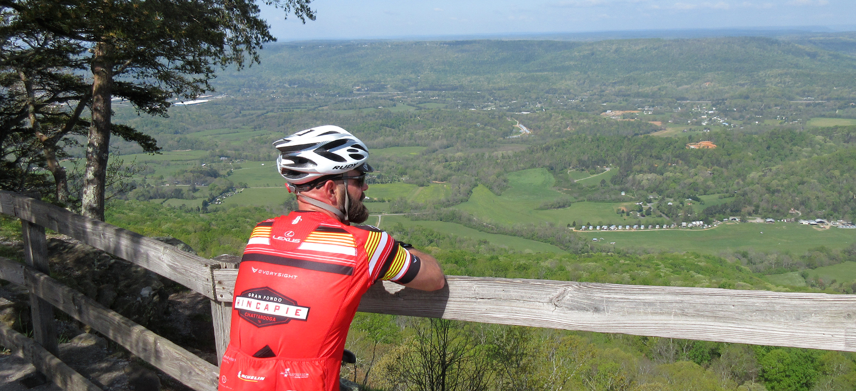
After another mile and a half of climbing, some of which is quite steep, you will finally arrive at Lookout Mountain Flight Park and all the extra leg-burning you endured to get there will suddenly seem well worth it as you look off the edge of the mountain at a panoramic vista that is hard to beat! Stretch your legs, take some photos and soak up the view at this scenic pit stop. If you need a beverage and snack, there are plenty to be found inside the office there at the Flight Park.
When you've had your fill of the vista, head back the way you came on 193 (mostly downhill this time!) and turn right onto Mt Olive. Watch for this turn around a mile and a half after leaving the Flight Park. It comes up fast and you don't want to miss it! Mt Olive is a lot more fun in this direction as it is mostly downhill. You'll stay on Mt Olive for about two and a half miles before it ends at a stop sign with Hinkle Road. Turn right here and then immediately turn left onto 157, also known as Lula Lake Road. Use caution as you pull out onto 157. Like 193, it may have some fast-moving cars.
About a mile after turning onto 157, you'll pass by Lula Lake Land Trust. This is a beautiful preserve that offers hiking, mountain biking, a couple of waterfalls and a scenic overlook. It's a gorgeous place to spend the day and we highly recommend checking it out when you have time to explore it properly.
The next four miles on 157 will seem like an eternity as you roll over a series of small climbs that will bring you closer to the City of Lookout Mountain. Finally you will come to a stop sign, and you will see a golf course on your right. Turn right here onto Wood Nymph Road and follow this fun little road as it winds around the golf course, offering some beautiful views of Covenant College in the distance.
After a couple of miles, Wood Nymph turns into Patten Road and you'll start to see the backside of Rock City on your right. Shortly thereafter, Patten becomes Mockingbird Lane and you will find yourself rolling by the entrance of Rock City. Rock City Gardens is an immensely popular tourist destination that offers some spectacular views (you may have seen the iconic "See Rock City" signs painted on barn roofs throughout the Southeast), and you will want to use caution as you pass through the crowds.
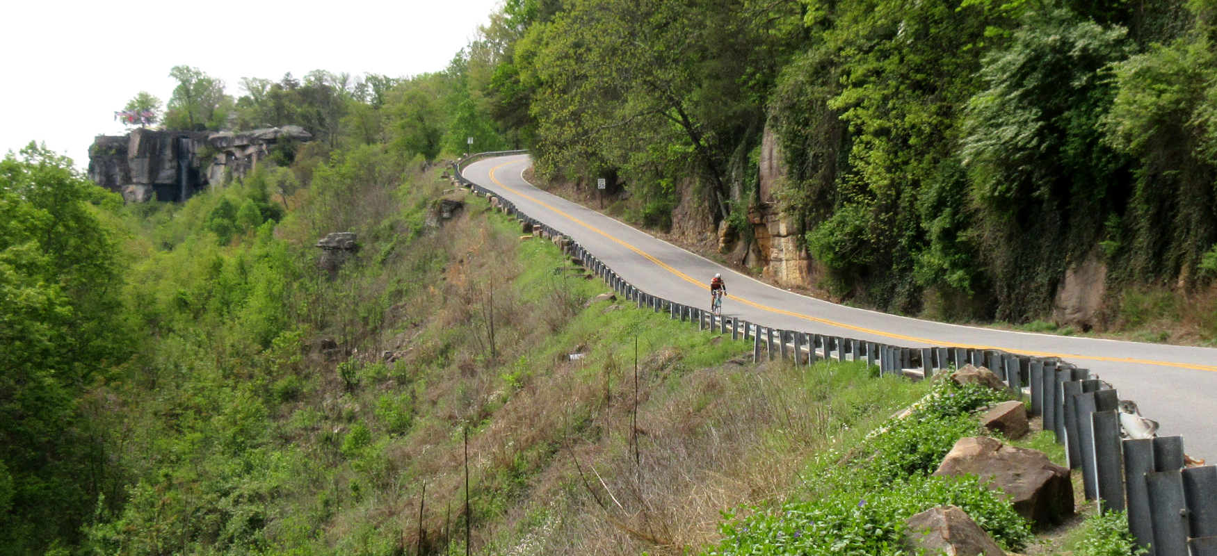
After making it past Rock City, you will come to a stop sign with Red Riding Hood Trail. Take a deep breath here and gather your wits, as you'll soon be bombing down the mountain! After turning right at the stop sign you will immediately be greeted by a sweeping view off to the right. Try not to get too distracted by the scenery though. This is a fast descent and you'll want to keep your eyes on the road. While the majority of the descent is a fast downhill, there is one short stretch where you'll have to pedal uphill. There's a pull-off on this stretch, which you might take advantage of to let cars come around you. Also be advised that the descent gets curvier at the bottom and comes to an abrupt stop at a traffic light at the bottom.
Take a left at the light and then take your first right onto Tennessee Avenue. Take the very next right to stay on Tennessee Avenue and follow this neighborhood street for the next couple of miles. Please note that you'll need to veer left at mile 29.4 to stay on Tennessee Ave, and you'll also need to veer right at mile 30.1. Eventually, Tennessee Avenue ends at a stop sign at 193.
This is a busy road so you'll need to use caution as you turn left onto it. You'll only be on it for less than a quarter-mile before you veer off to the right onto Chattanooga Valley Road. A half-mile later you'll be back at Treetop Hideaways where you can unwind after conquering Lookout Mountain!