31 Miles / 2000 Feet of Climbing
Head out to the rolling low-traffic farm roads near Ringgold and venture all the way to Red Clay State Park - the last capital of the Cherokee Nation!
Potential Route Modifications: Because this route uses roads that crisscross through the farmland northeast of Ringgold, there are numerous ways to shorten it. Turning onto Dry Valley Road at mile 12 rather than going all the way to Red Clay State Park reduces the route by a little over 3 miles and also cuts out a couple of the tough climbs. You can eliminate an additional climb by turning right onto Carson Road at mile 11 and following it down to Old Tunnel Hill Road, which will turn the route into 25 miles with 1500 feet of climbing. You can shave off another 1.5 miles by skipping the Bill Stewart/Lowe Road loop.
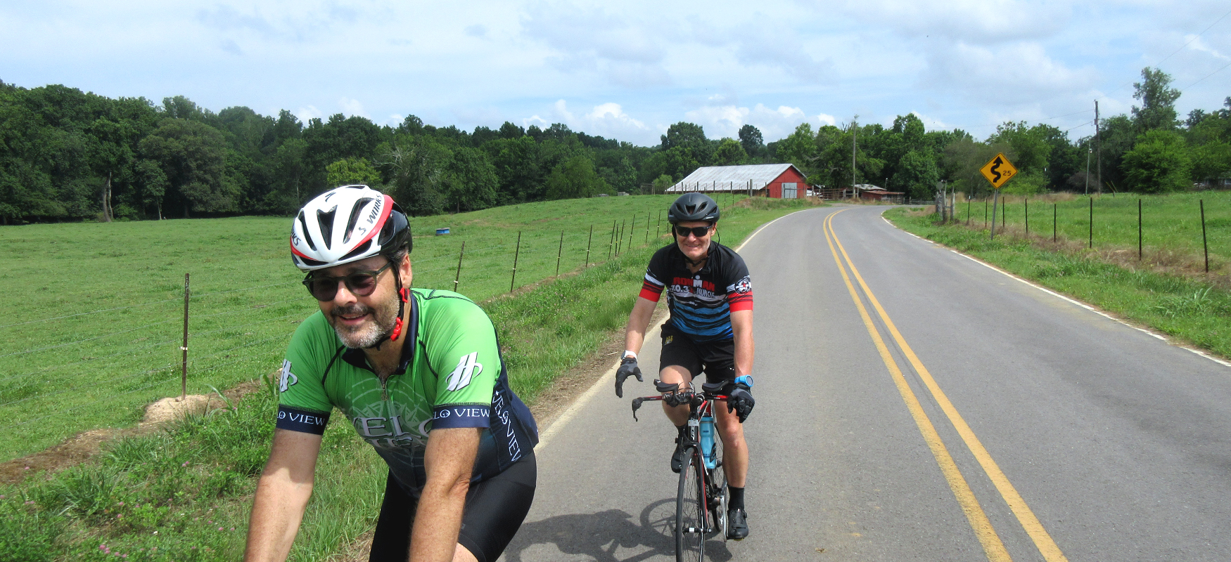
While it would be convenient to start and finish in downtown Ringgold where all the great restaurants and shops are, it would require riding on Hwy 41, which is a high-traffic, fast-moving road that you really should avoid riding. We recommend driving east of town a short 2.5 miles to McConnell Park, which has parking, restrooms, and easy access to the low-traffic backroads.
From the park, turn right and ride the shoulder the short distance to Salem Valley Road. Turn right onto Salem Valley and you'll head up a gradual climb for about half a mile before enjoying a descent of about the same length. From there the road settles into a series of smaller climbs and descents through a mix of farmland and rural residences, which is typical for this ride.
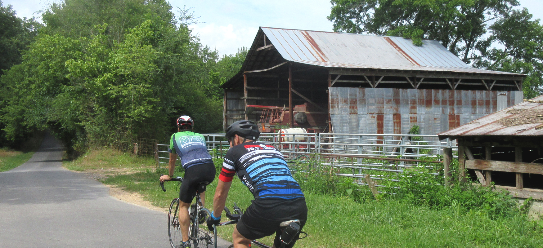
Around the 3-mile mark, the road name will change to Rifle Range, but you won't notice the name change until you come to a stop sign at mile 4.3 where you will turn right onto Salem Valley Road - which will seem odd since you thought you were on Salem Valley the whole time! After this turn you will continue another 2.5 miles until you come to a "T" intersection with London Lane. (The Grey Flower Deli is on your left at this intersection in case you need to refuel.)
Take a right onto London Lane, and a little less than a mile later take a left to stay on London lane. A mile later you'll come to a stop sign where you'll turn right onto the newly paved McGhee Road and follow it a quarter mile to a four-way stop with Alabama Road. Continue straight on McGhee, which veers to the left and goes straight uphill! The climb is short but super steep (with grades in the high teens), so make sure you're in the right gear as you move through the intersection onto the hill.
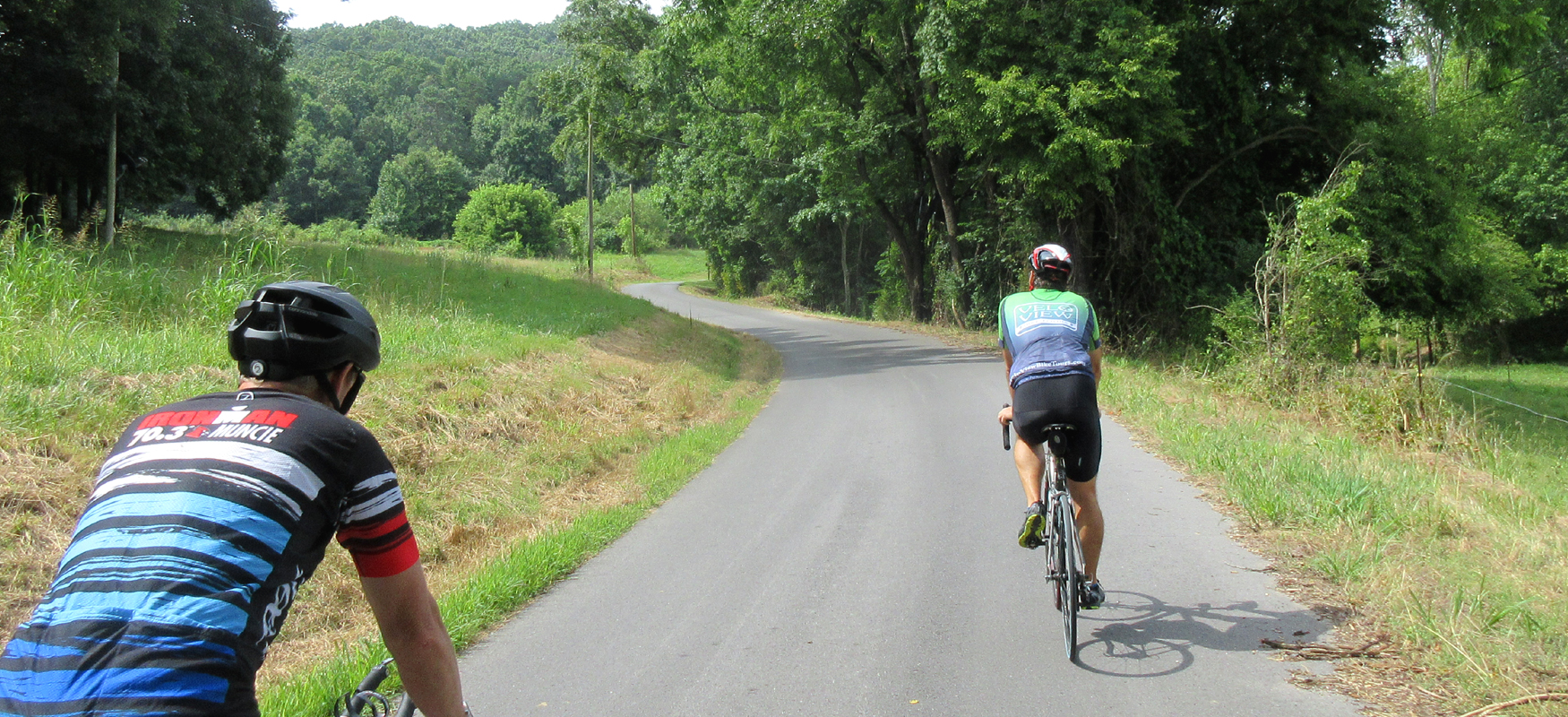
Right after you crest the hill, you'll come to a "T" intersection with Red Clay Road. After turning right onto Red Clay, you won't have any more turns for the next five miles. About halfway through this stretch of road, you'll go under a low train trestle and onto a short steep climb. It's the first of two significant climbs on Red Clay Road. Neither of the climbs are as steep as the McGhee climb, but you'll still want to be ready for them.
After cresting the second climb, you'l drop down a fun descent through a wooded section of roadway. Watch your speed on the way down, as the descent ends abruptly at a stop sign. Turn left here onto Red Clay State Park Road and follow this road as it skirts the edge of the park until you come to the park entrance about three quarters of a mile later on your left.
The visitor center at Red Clay State Historic Park makes for a great rest stop with nice facilities (clean restrooms, vending machine with drinks, etc.). The visitors center also does an excellent job of interpreting the historic significance of the area, which was the last capital of the Cherokee nation before they were forced to head west on the Trail of Tears.
The park encompasses 263 acres, and while it's not accessible by bike, there are a couple of good hiking trails that lead to an overlook tower, an historic farmstead, and the Blue Hole spring. Consider your bike ride pit stop a preview for a return trip!
After your break, take a right out of the park, and then turn right again to head up the climb that was so much fun to bomb down on your way to the park. (At least there's shade while you slog your way back up the hill!) Watch your speed after cresting the climb and descending the other side, as you'll need to turn left onto Dry Valley before you fully bottom out.
Dry Valley Road is a great road with excellent farmland scenery. After a mile on Dry Valley you'l cross some railroad tracks (use caution!) and come to an intersection with Apison Road. Apison Road might have a little more traffic so watch for cars as you make this right turn. A quarter-mile later take your first left onto Parrot Road, which is a fun curvy tree-lined road that makes for a nice change of pace from all the wide-open farmland.
Parrot Road runs about a mile before coming to a "T" intersection with Chattanooga Road. After turning right here, you'll launch into a climb that will last almost half a mile before dropping off sharply down the other side.
Again watch your speed on the descent, as you'll need to turn left onto Old Tunnel Hill Road at the bottom of the descent. You'll only be on Old Tunnel Hill for a short (very pleasant) stretch before you come out of the trees at an intersection with Stewart Road. Turn left here and follow Stewart Road about half a mile before turning left again onto Bill Stewart Road, which is a narrow country road that starts off with a nice little climb followed by a fun descent! After the descent, the road flattens out and comes to a "T" intersection with Lowe Road where you'll turn right.
Lowe Road starts off like yet another road cutting through farm country, but it soon changes to a fun roller coaster as it dips down into the woods following Tiger Creek all the way back to Stewart Road. Take a right on Stewart Road and then immediately turn left onto Headrick Road, which follows Tiger Creek for a bit more before launching into a short climb. Actually, it's a series of short climbs, so use the level parts to recover as it seems like there's always another climb coming up!
You will finally reach a true summit on Headrick and you'll get to enjoy a fast but short descent before coming to a stop sign at Keith Road. Keith Road could be busy, so use caution as you take a right here. Soon after pulling out, you'll take your first left onto Spivey Road.
Spivey starts off as a fun, mostly downhill road, but after bottoming out at Sugar Creek it turns up and continues going uphill until you come to a "T" intersection with Keith Salem Road. Turn right on Keith Salem and do one last bit of uphill before curving down to another "T" intersection, this time with Salem Valley Road.
Take a left on Salem Valley, and then turn left again onto Rifle Range Road as you come around the corner. At this point you'll be back on familiar territory as you follow Rifle Range (which becomes Salem Valley Road) all the way back to where you started at McConnell Park. From there it's a super short drive into Ringgold where you can recover with a great meal and cool down your legs with a stroll through their charming downtown!