35 Miles / 2600 Feet of Climbing
A fun winding route through a mix of woods & farmland with a few waterfront sections too. No major climbs but plenty of rolling short ones!
Potential Route Modifications: There are numerous ways to shorten or lengthen this route. Skipping the Johnson Road/Parker Loop circuit near Birchwood will reduce the route by roughly 9 miles. (Take Bunker Hill/111 from Birchwood rather than Johnson Road and then pick up the route at the intersection of 111 and Blythe Ferry Road.) You can shorten the route by 15 miles and skip Birchwood altogether by turning right on Sam Smith at mile 8 (rather than left) and then following Gunstocker Road/111 to Blythe's Ferry Road where you can pick up the route. For an even shorter loop (roughly 14 miles total) turn right off of Gunstocker Road/111 onto Posey Road and pick up the route at Old State Hwy 58. If you want more distance, you can start farther south on Ooltewah-Georgetown Road and ride north until you connect to the route.
We've mapped this route from the Dollar General in Georgetown, but you could also ride it starting at the Citgo in Birchwood. Or if you wanted more miles, you could start farther south on Ooltewah Georgetown Road at the Circle K or Countryside Cafe. Wherever you decide to start, be sure to check with the store before leaving your vehicle there, and always buy something in exchange for their parking and restrooms.
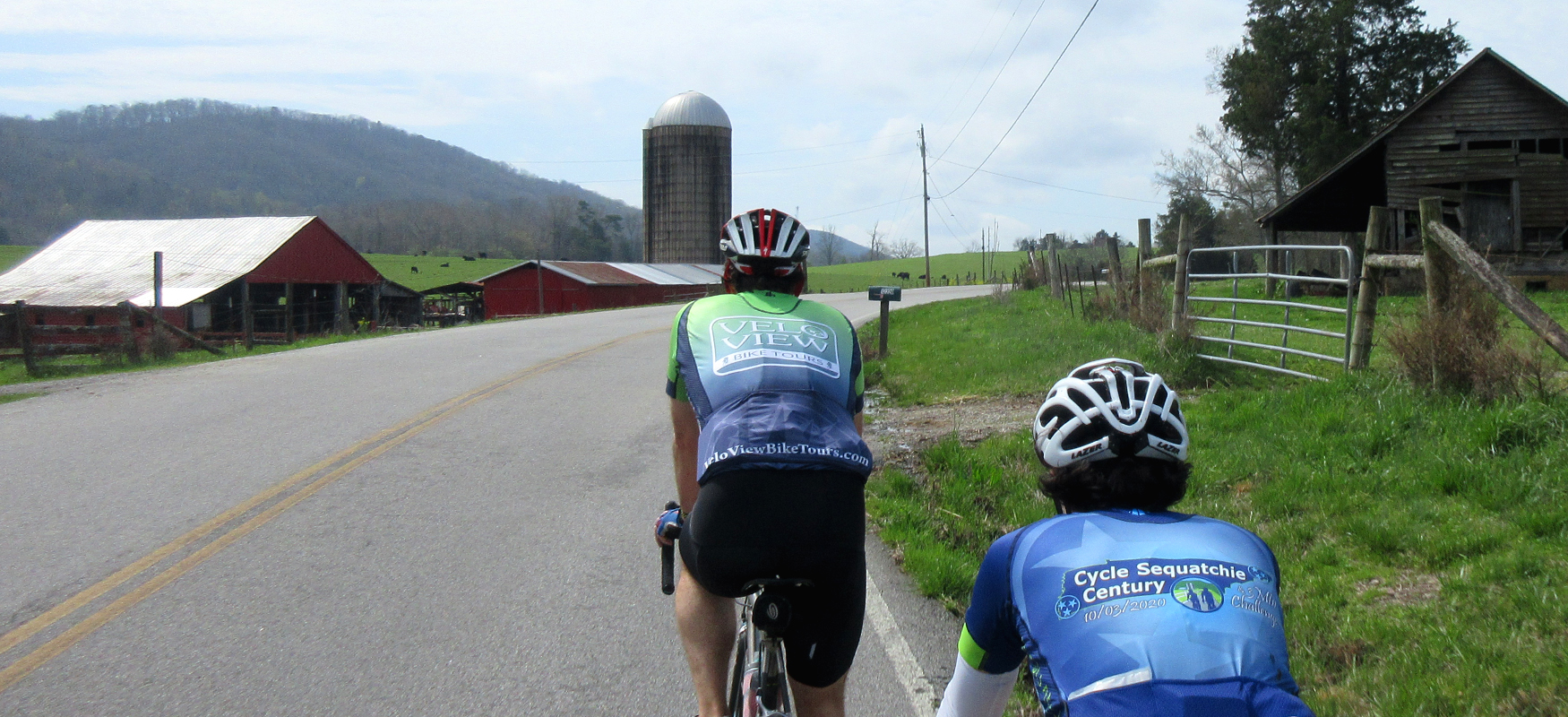
From Georgetown, head south on Ooltewah Georgetown Road. This road might have a little traffic close to town, but it should thin out the farther south you travel. All the same, be aware of traffic and stay to the right. It's a beautiful start to the ride with sweeping views of open farmland on both sides of the road.
After a mile and a half, take a right onto Meadowview Road. Less than a mile later, you'll turn right onto Grasshopper Road. Both Meadowview and Grasshopper continue with the same beautiful farmland scenery that you started with, making the first two and a half miles of the ride a great start!
Grasshopper Road will run straight into Hwy 58, where you'll carefully cross and continue on Grasshopper on the other side of the highway. This section of Grasshopper is the polar opposite of the farmland you just rode through, as it is currently being developed as a residential neighborhood. That makes for potentially more traffic, but it should be slow since this is now a neighborhood street.
A mile after crossing Hwy 58, and following a short but steep hill, you'll veer right onto Bettis Road. This is a fun road (if a bit bumpy) with plenty of curves and ups & downs and plenty of tree cover. There are a number of residences tucked in the trees, but the road definitely has a rural atmosphere and feels markedly different than the farmland on the other side of the highway.
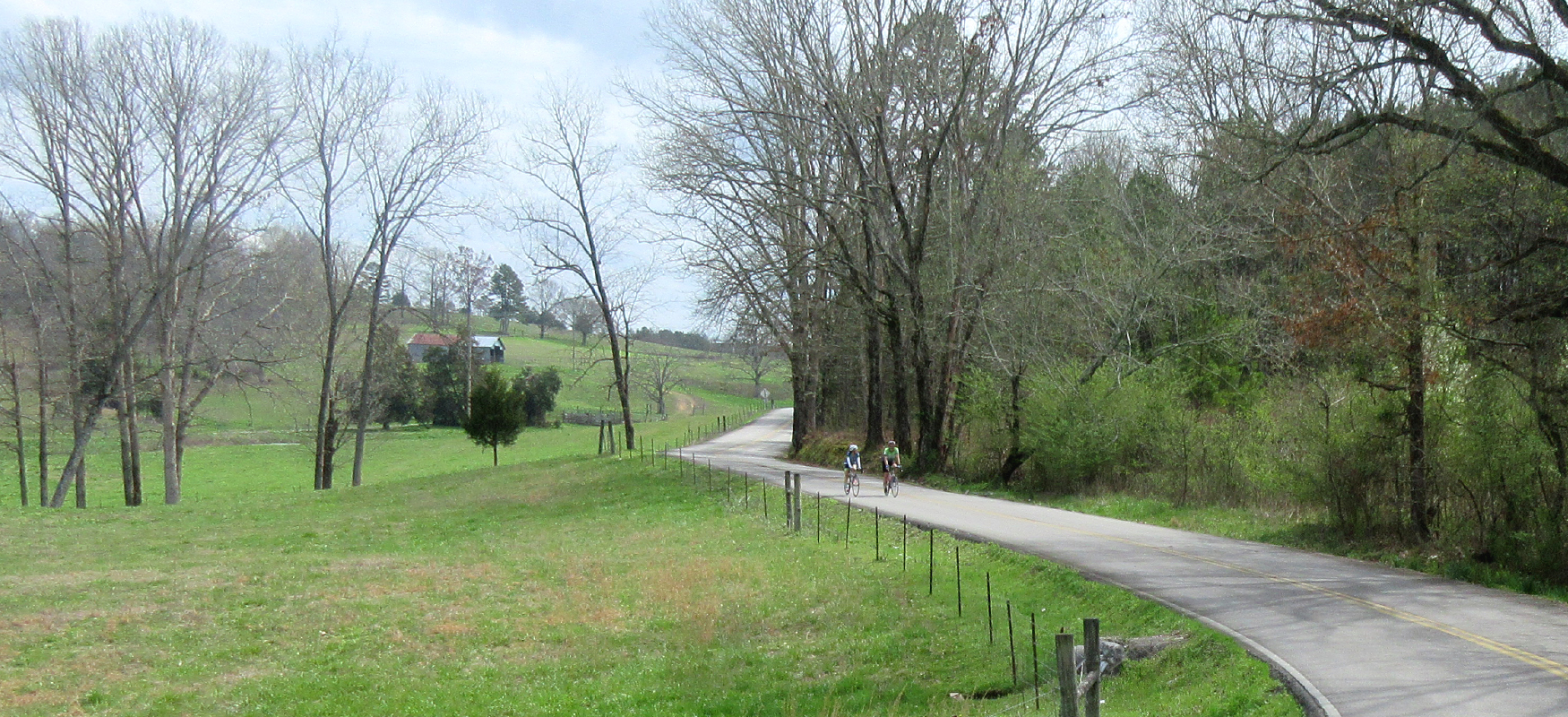
Bettis Road ends after a couple of miles with an odd "Y" intersection. Veer to the right as the road splits and then turn right onto Cranfield Road. Cranfield will continue the climb you started on Bettis before rewarding you with a nice downhill. This is a great road with a mix of trees and farmland. It does have a little up & down, but it's mostly down, which makes the curves that much more fun!
The name of the road will change from Cranfield to Pierce as you make a righthand bend in the first quarter-mile after leaving Bettis, but you won't really notice. In total, this stretch is almost three miles before it ends at a "T" intersection with Sam Smith Road, where you'll turn left.
This is another fun road (with smoother pavement) that starts off with a downhill and open farmland on one side and woods on the other. The fun is interrupted by one small hill and then it ends at a "T" intersection with Birchwood Pike.
Birchwood Pike is a more significant road than the little backroads you've been riding, so you'll need to be more attentive and stay to the right. After turning right onto Birchwood, you'll ride a little over a mile and a half before coming to a stop at Hwy 60. Carefully proceed straight across the highway onto Defriese Road, which is a narrow wooded road that will bring you back to Hwy 60 in less than a mile.
At this point, you'll see a Citgo gas station on the other side of the highway which is a good place to stop if you need a snack or a bathroom break. On the other side of the Citgo is Johnson Road, which is where the route continues. So carefully cross Hwy 60 and roll through the Citgo parking lot and then take a right on Johnson Road.
After turning onto Johnson Road, you'll be in a rural residential area with a lot of curves and ups & downs. Because there are a lot of blind curves, be sure to stay to the right of the road. A mile and a half after leaving the Citgo, Johnson Road will split off to the right. Stay to the left here and go straight, which will put you on Parker Loop Road.
Parker Loop will give you more of the same curvy up's & down's, and eventually it will bring you back to Johnson Road. Be sure to turn left onto Johnson Road rather than continuing straight at mile 17.3. This turn is easy to miss so pay attention or you'll end up back at the Citgo!
After making this left, you'll ride by lakefront houses and the road will change names to Shahan Road with a noticeable change in pavement quality. Despite the rough road, this is an enjoyable section, as the road narrows and loses the middle yellow line, giving it the feeling of a country lane. It will also bring you even closer to Chickamauga Lake.
After crossing a little bridge in a cove, you'll climb a short hill and veer to the right onto Burton Road. Burton continues to climb until it ends at a stop sign at Hwy 60. Take a right onto the shoulder of Hwy 60 and follow it half a mile until you see a sign pointing to Blythe Ferry Road on the other side of the highway.
Carefully cross Hwy 60 and take Blythe Ferry Road just under a mile before turning right onto Blythe Ferry Road. Yes, that sounds confusing, but Blythe Ferry Road is the name of both the road you're on coming from Hwy 60 and the road that you'll need to turn on to head south. It will make more sense when you see it.
The good news is that after turning right at mile 21 (from Blythe Ferry Road onto Blythe Ferry Road) you won't have to make another turn for the next 6.5 miles! Blythe Ferry Road meanders past rural residences and farmland with rolling terrain and limited traffic. All the same, it's a good idea to stay to the right of the road, especially towards the end of this stretch as you approach Hwy 58.
Before reaching Hwy 58, you'll come to a stop sign at Eastview Road. This road can be busy, so use caution as you go straight across and proceed to the next stop sign which is Hwy 58. After another cautious crossing here, the road name will change to Fisher Hollow Road and the pavement surface will change to chipseal. The yellow line will also disappear and you will be in a noticeably more rural and wooded area.
This is a great stretch of road that lasts about two and a half miles before ending with a beautiful farm and a short hill climb. At the top of the climb, you'll come to a stop sign where you'll turn right onto Sugar Creek Road.
After a mile and a half on Sugar Creek, you'll come to a stop sign at the intersection with Gamble Road. Gamble Road has smooth pavement and a yellow line, which is an indication that it may also have faster moving traffic. So use caution as you turn right onto Gamble and stay to the right side of the road. Despite the potential for more cars, it's a great road with wide open farmland scenery.
About a mile after turning onto Gamble Road, you'll turn left onto Old Hwy 58, which will run you south for two and a half miles past rural residences until you reach Hwy 60 and your starting point in "downtown" Georgetown.