42 Miles / 2200 Feet of Climbing
Cruise through the rolling farmland from Cleveland all the way to the Hiwassee River on the beautiful backroads just west of town.
Potential Route Modifications: There are plenty of ways to shorten this route: Skipping the initial Harris Creek/Blythewood/Pleasant Grove loop will shave off 3 miles. Taking a right on Bigsby Creek Road at mile 14 and cutting across to Rabbit Valley Road will reduce the distance by roughly 18 miles. Taking a right on No Pone Road at mile 19 and heading south from there will reduce the distance by 9.5 miles. Skipping the Eads Bluff loop at the north end of the route (mile 22.5) will cut off close to 3 miles.
If you're looking for a ride with rolling hills, farmland scenery, an easy-to-access start/finish, and plenty of options for different distances this is the ride for you! We've mapped it out at 42 miles, but it can easily be modified to 39, 36, 30, 24, or 21 miles.
We recommend parking at the Farmhouse restaurant in south Cleveland, as it provides easy access to the backroads west of town and even easier access to a great post-ride meal!
From the parking lot the route will loop you around behind the restaurant to avoid having to ride on Harrison Pike. This short diversion will lead you to Sipes Road SW, which will take you south through a neighborhood on the other side of Harrison Pike. A mile and a half into the ride, you'll come to a stop sign at Harris Creek Road.
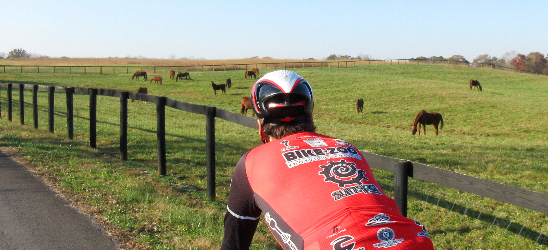
Turning left onto Harris Creek will take you on a beautiful loop around some gorgeous horse farms before bringing you almost all the way back to the stop sign at Harris Creek Road. Skipping this loop will reduce the ride by roughly 3 miles.
Either way you'll end up heading west on Harris Creek Road which will take you underneath I-75 and past the extensive operations of Swafford Nursery. Follow Harris Creek Road until you hit the stop sign at Old Harrison Circle. Take a right on Old Harrison Circle and climb the hill up to the stop sign at Harrison Pike.
The route does a jog here, with a left on Harrison Pike followed by a quick right onto Medlin Road, which, after a couple of curvy tree-lined miles, will "T" into White Oak Valley Road. After turning right onto White Oak Valley Road, you'll enjoy 6 miles of wide open farmland vistas. (There are a couple of stop signs along his stretch. Turn left at both of them to stay on White Oak Valley.)
White Oak Valley Road eventually runs into Georgetown Road/Hwy 60. This is a busy road, but you won't be on it long. Turn right and then immediately left onto Mt Zion Road. A little over 3 miles later, you'll take a left onto No Pone Road. ("Pone" means unleavened cornbread in the form of flat oval cakes or loaves, originally as prepared with water by North American Indians and cooked in hot ashes. Not sure what that has to do with this road, but we felt the need to look it up after seeing the name!)
A half mile later, you'll take a left onto Gum Springs Road followed by a right onto No Pone Valley Road, which trends downhill and is full of fun curves, making it one of our favorite stretches on this ride!
Our only complaint about No Pone Valley Road is that it doesn't last long enough. After 2.5 miles, you'll run into Lower River Road/Hwy 306. This is a busy road, so you'll want to use caution turning onto it. You'll take a right here and head uphill for less than a quarter mile before turning left onto Eads Bluff Road.
Eads Bluff Road is a 3.5-mile loop with some punchy climbs/descents and great views of the Hiwassee River, which at this point looks more like a lake as it's joined by Candies Creek and Rogers Creek at this point. Roll down the short gravel boat ramp at mile 24 to take in the views! (It's easy to miss the boat ramp as the turn-off sits at the bottom of a hill that will have you flying!)
Eads Bluff Road will eventually bring you back to Lower River Road, where you'll take a left and then an immediate right onto No Pone Road. After working your way up a tree-lined climb, you'll be rewarded with a fun descent and some great views of the valley.
At this point, the route becomes a pretty straight shot home, as you head south on No Pone Road, which becomes Rabbit Valley Road after you cross Georgetown Road/Hwy 60 around mile 32.5. (A couple of miles later you'll turn left onto Old Freewill Road and then immediately right to stay on Rabbit Valley Road.)
Rabbit Valley Road ends at its intersection with White Oak Road, where you'll take a left and roll a very short stretch to Harrison Pike. Harrison Pike can be a busy road, but you'll only be on it for less than half a mile before taking a right onto Laurel Bluff Road. (There's a Conoco convenience store on the left in case you need anything to get you through the last five miles of the ride.)
Laurel Bluff Road runs about a mile and a half before it "T's" into Harris Creek Road. (There is one stop sign on Laurel Bluff Road where you'll need to turn left to stay on Laurel Bluff.)
When you reach Harris Creek Road turn left and follow it back under I-75 to the stop sign at Sipes Road. Go straight at the stop sign, through the neighborhood, across Harris Pike and around the backside of the Farmhouse Restaurant, where your post-ride reward awaits!