46 Miles / 2200 Feet of Climbing
Whether it's one loop or two, you'll enjoy a beautiful challenge on low traffic farm roads and tree-covered climbs!
Potential Route Modifications: Turning left on CR 42 instead of right avoids the killer climb and makes the ride a nice 22-mile loop with only 550 feet of climbing, most of which is on the moderate climb at mile 7. If you're feeling tired towards the end of the route, you can cut out a little over a mile by skipping the CR 155 detour and staying straight on CR 45. On the other hand, if you're feeling good at the end of the ride, you can add a mile by turning left on CR 169 off of CR 45 at mile 33. It's a nice little loop similar to CR 155 that brings you back to CR 45.
As noted in the "potential modifications" section above, this can be a moderate challenge or a killer challenge, depending on whether you just do the first loop or do both loops. The first loop does have a legitimate climb but the grades are low and it's only about half a mile - perfect for a short workout. If you take on the full challenge, expect a much different experience with a climb that is closer to a mile and a half with grades exceeding 20% in places! It's no joke, but it's a great experience and you'll get a fun curvy descent as a reward. Of course, the route isn't just about the climbs. There are plenty of wide-open miles in between that balance out the suffering nicely. These flat miles also serve as a great warm-up and cool-down.
We recommend starting the route at the historic depot in downtown Stevenson. There's plenty of parking and the depot is steeped in history. The original depot was built in 1853 and was very active during the Civil War, so much so that Harper's Weekly named Stevenson "one of the seven most important cities in the south." After the war, the original depot burned down and was replaced by the current brick depot and hotel which opened in 1872. Over the years, train traffic diminished in Stevenson until finally the last railroad office closed in 1976. Thanks to the efforts of local citizens, the old depot and hotel were spared demolition and instead were renovated and repurposed as a museum in 1982 that now houses a wide variety of historical artifacts.
From the depot head out on Hwy 117 and take your first left half a mile later onto County Road 45, which will take you past a small city park and some residences before bringing you back to Hwy 117 a little less than a mile later. (If traffic is light on Hwy 117, you can just stay on that road as you leave town rather than taking CR 45, which runs parallel to it.) Take a left on Hwy 117, and a quarter-mile later turn left again onto CR 55. CR 55 quickly takes you into the countryside with a nice mix of wooded and farm scenery, including a few places with horses.
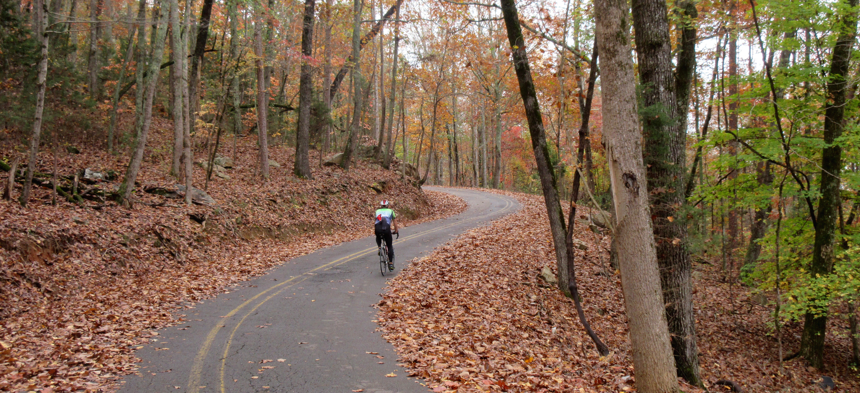
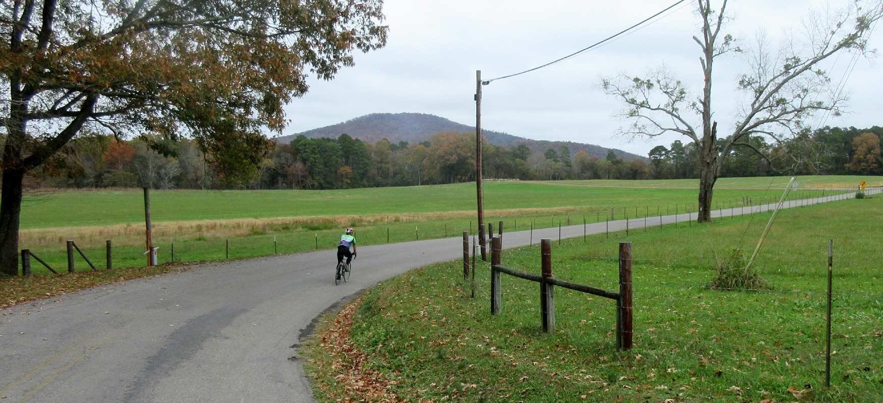
Four and a half miles after leaving Hwy 117, turn left to stay on CR 55. This will take you through a noticeably different type of landscape as you head into a wilderness preserve. What starts out as swampland soon turns into a beautiful wooded climb as you head up and over the ridge. The climb is only half a mile and the grades are single digit and manageable, which makes it possible to set a nice tempo and enjoy the scenery. Once over the top, you'll enjoy a fast descent down into wide open farmland, with CR 55 eventually ending at a stop sign at CR 42.
If you struggled on the climb, consider taking a left onto CR 42 and making it a short loop back to Stevenson. Otherwise, take a right on CR 42 and continue on to the big challenge of the day!
A little more than two and a half miles after turning onto CR 42, take a right onto CR 39. Use the next two miles as a warm-up for the big climb, as CR 39 takes you straight into the face of the ridge. After two miles of a slight incline, it bends hard to the right and goes straight up. Try not to blow up on this first pitch, as you'll soon discover that there's really no relief as you continue to climb. The steep pitches are the hallmark of this climb (some exceeding 20%!), but what makes it extra challenging is the lack of recovery areas as you go up. The grades never let up until almost a mile and a half later as you finally reach the top of the ridge. It's a beast of a hill and undoubtedly one of the hardest climbs in the whole Chattanooga region!
After cresting the climb, try to catch your breath as you work your way across the top of the ridge. The rollers may seem harder than normal after the big effort to get up the climb, but, after you settle down, the rolling ride across the top of the ridge is actually very pleasant as you pass through wooded sections, farmland and some cool orchards. After a noticeable tease of a downhill (it's followed by a short climb!), CR 39 comes to an end at a stop sign with CR 33.
Turn left onto CR 33 and keep an eye out for traffic. It's not a busy road, but after riding with hardly any cars for the last several miles, you may have forgotten that the road is not just for bikes! After a couple of miles on CR 33, it will drop off the mountain on a descent that starts off fast and straight but soon takes you through a number of fun switchbacks. Watch your speed entering the corners and enjoy the rocky scenery as you drop down the 1,000 feet you worked so hard to conquer a short while ago.
As you finish the descent, the road will straighten out and you'll be back in flat farmland again. Roughly half a mile after bottoming out, take a left onto CR 32 and follow this refreshingly flat road for the next three miles before it ends at a "T" intersection with CR 42.
The flat riding continues after turning left onto CR 42. The road bends to the right after half a mile, and things should start to look familiar as you pass the turn for CR 39 and eventually pass the turn for CR 55. A couple of miles after passing CR 55, you'll come to the tiny community of Fackler. After crossing the train tracks, take a left onto CR 45. Look for the the old brick building that houses the fire department as a landmark for where to turn.
CR 45 is a painfully straight road that parallels the train tracks for almost three miles. (You can break up the monotony by turning left onto CR 169 a half-mile after turning onto CR 45 and doing that loop. It will eventually bring you back to CR 45, as mentioned in the potential modifications above.) Eventually CR 45 crosses to the other side of the train tracks and then bends to the left, which is your cue to look for CR 155.
Take a left on CR 155 and you'll be on a low-traffic loop that offers some great scenery, with a good mix of trees and farmland. After four very pleasant miles, CR 155 will bring you back to CR 45, where you'll take a left to continue on to Stevenson.
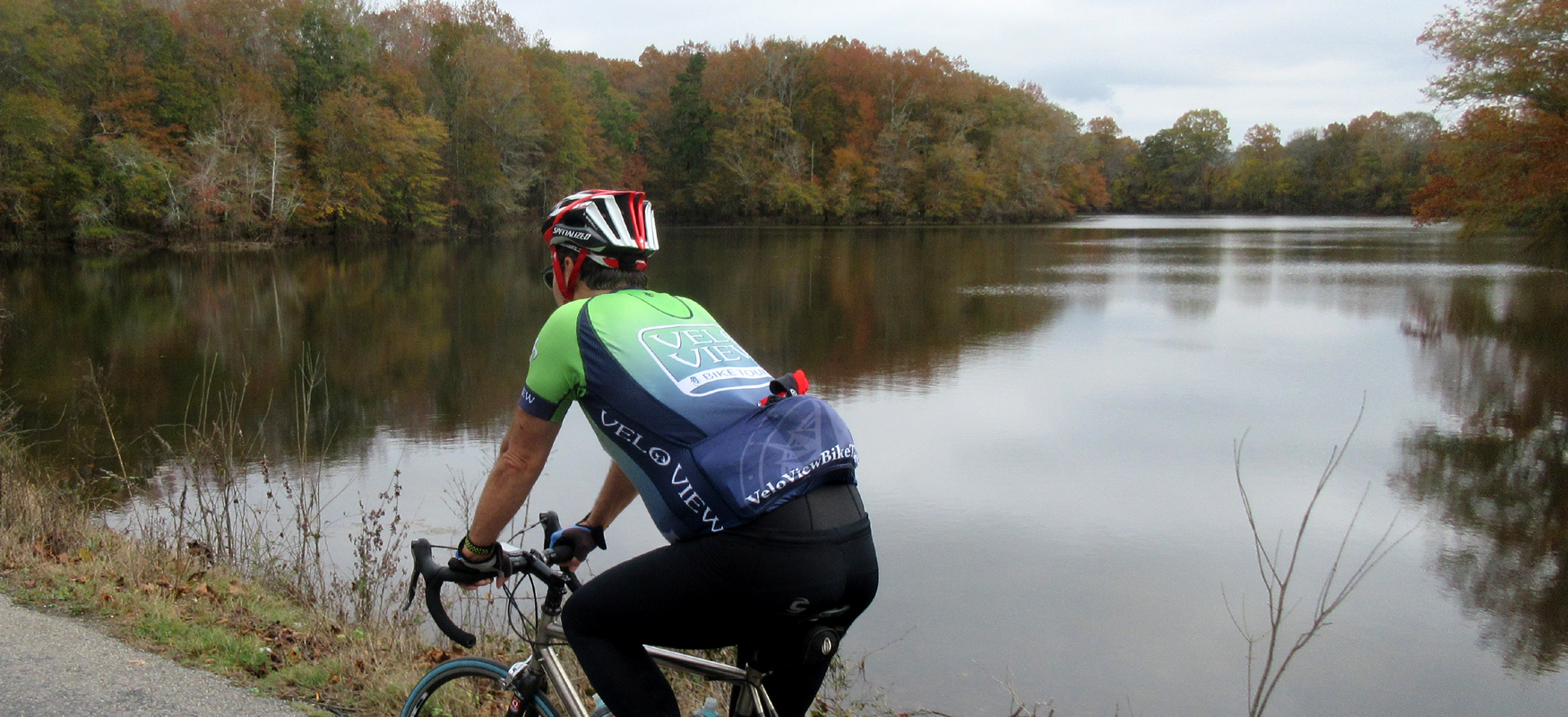
The next mile is a nice surprise as you'll be treated to some waterfront riding as you pass over a lagoon. (One of the bridges looks intimidating with an iron grid pattern, but it's safe to ride across.) After the waterfront section, you'll come back to the same city park that you passed at the beginning of the ride. Take a right at the park to stay on CR 45 and then turn right again when you reach Hwy 117. From there it's only a half-mile back to the depot where you started. After working up an appetite, we recommend refueling at some of Stevenson's hometown favorites such as Rodeo Santa Fe Mexican Restaurant or Fergs Pizza Bar!