28 Miles / 2200 Feet of Climbing
Ride this route as a climbing challenge, or skip the climb and treat it as a leisurely loop. Either way, you'll enjoy beautiful scenery on the low-traffic roads south of LaFayette!
Potential Route Modifications: Skipping the big climb up Pigeon Mountain reduces the total mileage by about 8 miles and shaves off about 1000 feet of climbing.
This a great ride that can be whatever you want it to be. With the climb up Pigeon Mountain, this ride is a serious challenge for experienced cyclists. Without the climb, it's a relatively easy loop. Either way, you'll enjoy beautiful scenery on the low-traffic roads south of LaFayette!
We recommend starting this ride at Station House in downtown LaFayette. It's an excellent restaurant and makes a fitting reward after the ride. The restaurant isn't open before lunch, so if you're looking for a bathroom break before the ride, stop at a convenience store on your way into town.
From the Station House parking lot, turn right onto Chattanooga Street and then immediately left onto Villanow Street and carefully cross a couple of railroad tracks. Take Villanow almost all the way to the traffic light and turn right into the little side street that passes in front of some of the historic downtown buildings. This section of downtown is quaint and is worth a return trip for strolling around after the ride. The side street runs about a block before intersecting with Patton Street, where you'll turn left and then immediately right onto Main Street. (If you're starting at a busy time of day, you might consider using Cherokee Street instead, which runs parallel to Main Street and is one block to the west of it.)
Once on Main Street, you'll roll downhill for about half a mile before turning right onto Municipal Park Drive which leads to the LaFayette Parks & Recreation building (the start & finish of the annual Honeybee Bicycle Ride!). Municipal Park Drive will take you around behind the Parks & Rec building and over to Foster Mill Drive, where you'll turn right. Depending on the time of day, this road may have a few cars, so stay to the right and be aware of passing vehicles.
A little over a mile after turning onto Foster Mill, you'll come to an intersection with Shattuck Industrial Blvd, which is several lanes wide and may have some fast-moving traffic on it. Proceed with caution straight across and continue south on Foster Mill. Roughly a mile and a half later, Foster Mill ends at a "T" intersection with Broomtown Road. After turning left here, you should notice a change in scenery as the landscape opens up and transitions into rural farmland.
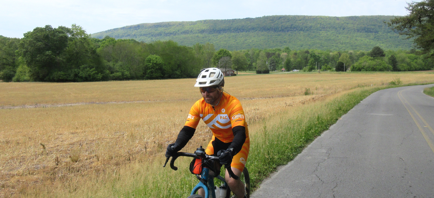
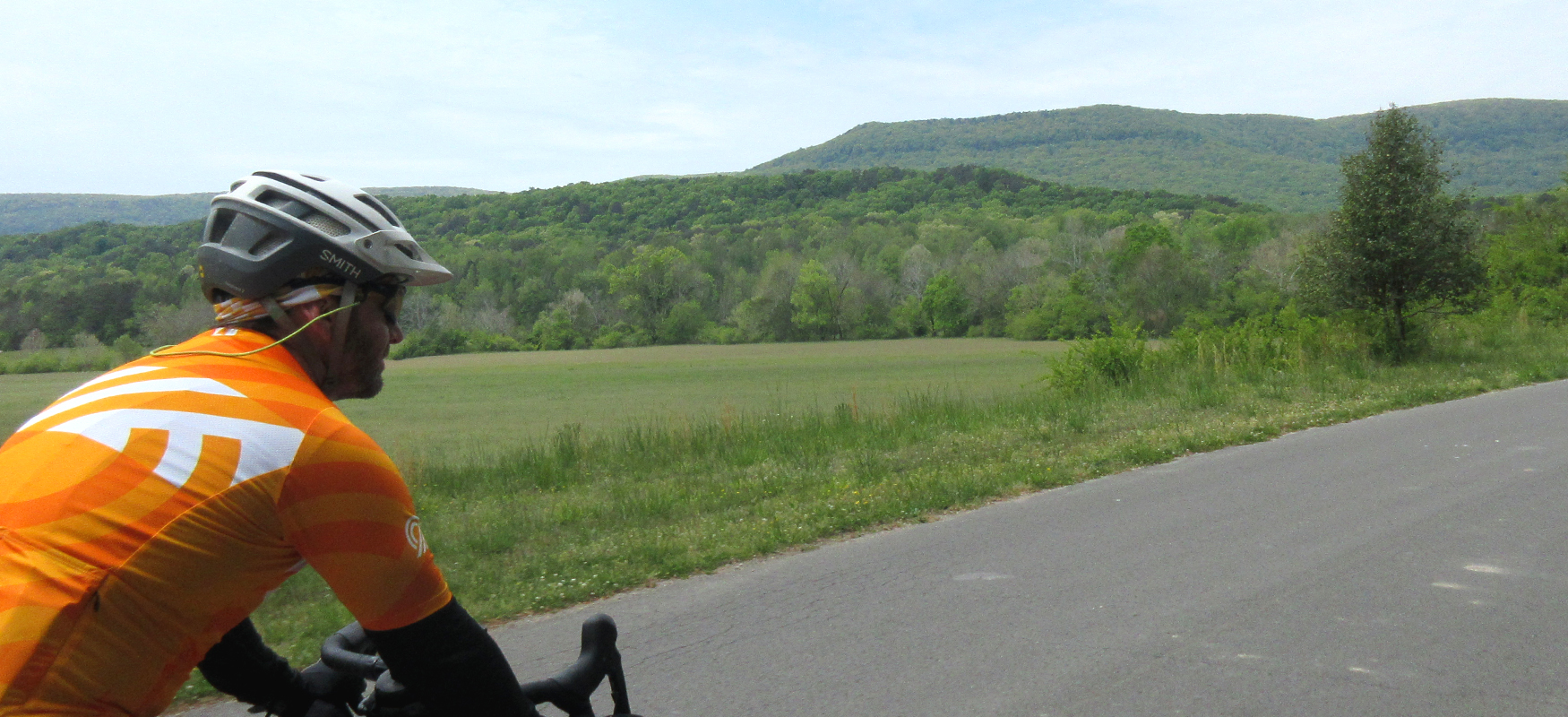
After four miles of pleasant riding, look for Parker Lane on your right. This turn should be somewhat apparent as Broomtown will have a "Dead End" sign at this intersection indicating that you've pretty much reached the end of that road. After turning right onto Parker Lane, you'll be greeted with a beautiful view of Pigeon Mountain in the background with open farmland in the foreground. You'll enjoy a half mile of this gorgeous view before coming to a stop sign at the intersection of 337, where you'll turn left.
This is another potentially busy road with fast-moving traffic (depending on the time of day), so ride single file and stay to the right. Fortunately, you're only on 337 for half a mile before turning right onto Chamberlain Road. The next three and a half miles on Chamberlain Road will have a few minor hills and plenty of beautiful scenery with Pigeon Mountain off to your left. (Also look for the spring-fed Dickson Lake on your left a couple of miles after turning onto Chamberlain. It's a scenic view from the road, and it will be an easily identified landmark from the view on top of Pigeon Mountain.)
After three and a half miles on Chamberlain, you'll turn left onto Rocky Lane at the Crockford-Pigeon Mountain Wildlife Management Area sign. The WMA is similar to a state park and contains over 20,000 acres of protected land. While it is a very popular area for outdoor recreation (the rock climbing and caving are literally world class!), it is also popular for hunting and is actually closed to recreational activities, including cycling, during hunting season. Please check the website for more information about the WMA: https://georgiawildlife.com/crockford-pigeon-mountain-wma
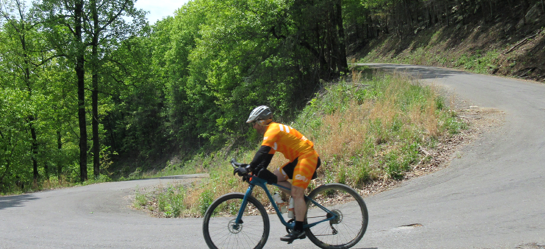
After turning onto Rocky Lane and entering the WMA, you'll begin a very gradual climb towards the base of Pigeon Mountain. The grade will slowly tick up as you pedal on and the road surface will worsen a bit as well, but not to the point of making it unrideable for skinny tires. The real climb starts a little over a mile after turning onto Rocky Lane as you enter a series of switchbacks and super steep ramps, some approaching 20%! The total climb is about four miles (from the turn off of Chamberlain), but the hardest part with the switchbacks is just under a mile.
After pushing through the switchbacks you'll reach a relatively flat area with some nice views off to your left especially in the winter when the leaves are down. This is a great section of road and will feel extra nice after making it past the double-digit grades!
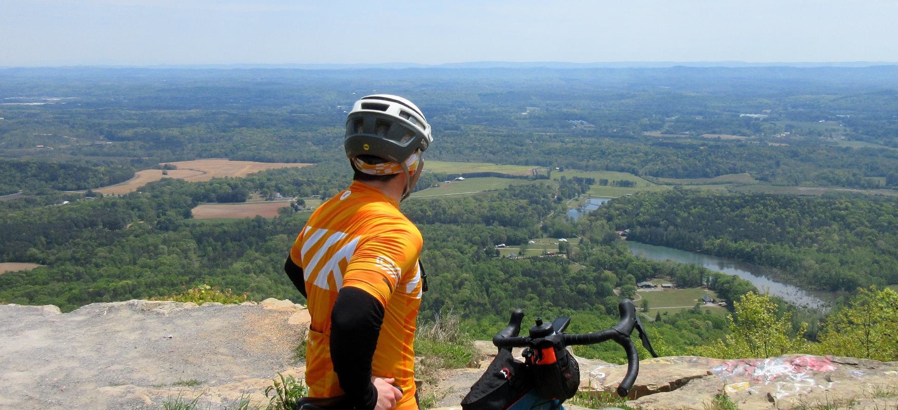
After some easy riding, the grade will kick up again and you'll come around one more switchback before arriving at a sign pointing to Hood's Lookout to your left. Hood's Lookout is only 2/10ths of a mile from the sign, but unfortunately this is where the pavement ends. It is possible to ride this gravel section on skinny tires, but if you feel uncomfortable with the traction and grade, just walk the short distance to the viewpoint which will open up on your left not too long after the pavement ends. The view overlooks Chamberlain Road and you'll see Dickson Lake directly below you. It's a fantastic panorama and you should take a moment to soak it in.
Having reached the overlook, it's time to carefully head back down the mountain. (If you have gravel tires you have the option of continuing on Rocky Lane for another eight miles until it ends at Doughtery Gap.) Please use caution on the way down and don't cheat on the blind curves. The road is lightly trafficked, but you never know when a vehicle might be coming around one of those switchbacks.
After rolling all the way back down to Chamberlain Road, take a right and then an immediate left onto Bronco Road. Bronco is a pleasant road with a good mix of farmland and rural residences. It also has some climbing, but it won't feel that bad compared to the monster you just conquered!
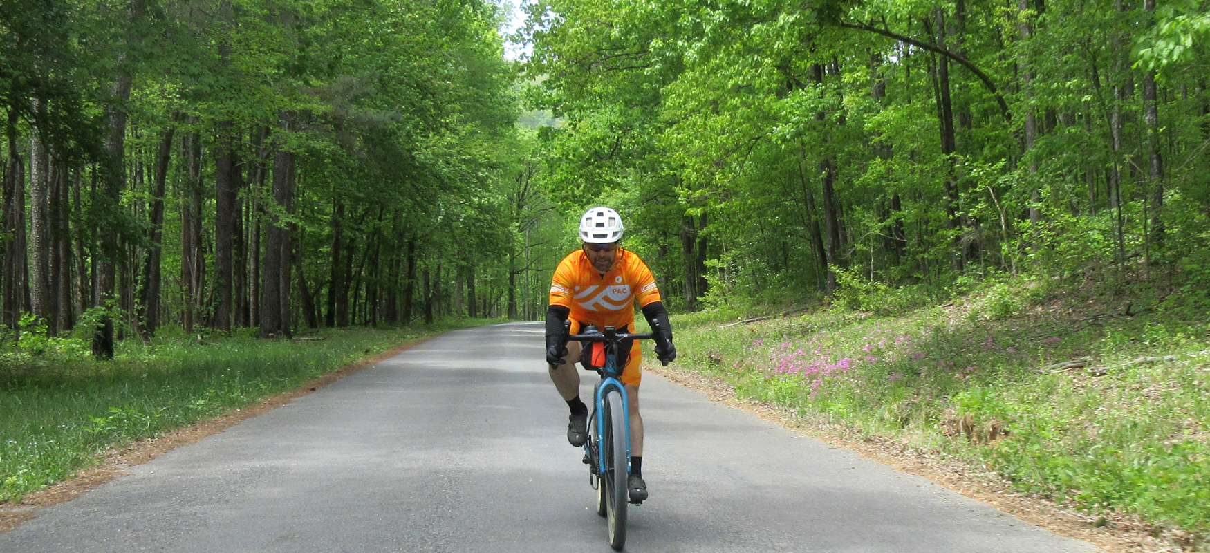
Almost three miles after turning onto Bronco, turn left onto Standifer Drive. Standifer is a short road that actually loops back to Bronco after a couple of miles. We could have skipped this little detour when designing this route, but we think it's a real treat, starting off with a fun downhill and then giving you a nice quiet tree tunnel of a road. It's a fun section, but it does require you to do another short climb as you work your way back towards Bronco. After cresting the climb, you'll see the intersection with Bronco in front of you, but before you get there, turn left onto Burnt Mill Road.
Burnt Mill gives you a nice straight shot back to civilization. In fact, you'll pass right by a school as you come to the end of the road. So pay attention to what time it is if you're riding on a weekday. Best to avoid school hours! Burnt Mill ends at 193, which is a busy road, so proceed with caution as you ride straight across it onto Hillsdale Road.
You'll be on Hillsdale for about a mile (gradually going uphill) before it ends at a stop sign with Chattanooga Street. Take a right on Chattanooga Street and enjoy a fast fun finish as you head downhill back into town. The downhill ends at a stop with Culberson Avenue and you'll want to pay attention to the road at this point, as there's a grate on the right side of the road that will catch your tires if you're not watching for it.
After going straight at the stop sign to continue on Chattanooga Street, you'll arrive back at the Station House restaurant where you can refuel with excellent food and tasty beer after a fun and challenging ride!