40 Miles / 2700 Feet of Climbing
An extended version of the 30-mile McLemore Cove Loop that adds a little more challenge and even more gorgeous scenery!
Potential Route Modifications: This route can be shortened by 10 miles and 1200 feet of climbing. Please see "McLemore Cove Loop (Short)" for all the details. (Just skipping the big climb after mile 23.6 reduces the route by 5.5 miles and 700 feet of climbing.)
UPDATE: Unfortunately, the Pigeon Mtn Grill has closed. We hope it's only temporary, and there's still a place to park at the corner of Hwy 193 and Cove Rd by the pavilion, but please be advised that you won't be able to get lunch there after the ride.
As with the short version of the McLemore Cove Loop, we recommend starting at Pigeon Mountain Grill, which sets you up to have a great lunch after the ride. (Because the restaurant is not open in the morning, you may need to stop at the Dollar General on your drive to the ride start if you need to use the bathroom prior to the ride.)
From the Pigeon Mountain Grill, head north on 341 for a couple of miles. This road is not heavily trafficked but vehicles may be moving fast, so ride single file on this section. After two miles, turn left onto Halls Mill Road. You will immediately be greeted by a "tractor crossing" sign which means you can relax about the traffic for a while! Watch the pavement though, as the road is not in the best shape.
A mile and a half after turning onto Halls Mill, you'll come to a "T" intersection with Kensington Road, where you'll turn left. After passing by a picturesque farm on the right, you'll turn right onto A1 Leet Road. This turn comes up quickly (just a quarter mile after turning onto Kensington Road), so be on the lookout for it.
A1 Leet is a short connector road that takes you to a "T" intersection with Prospect Road, where you'll turn right. The next mile on Prospect is almost all uphill. As you crest the hill and start the descent, look to your right for Marble Top Road. Take a right on Marble Top (and onto another little climb!) and follow it about a mile and a half until it intersects with 136, also known as Lookout Mountain Scenic Highway.
136 may have some traffic, so use caution as you turn left onto it, and ride single file down to the four-way stop less than a mile away. At the stop sign, turn left onto 193 and continue to ride single file for the next quarter-mile until you see Shook Road on your right. Turn right onto Shook and you will once again be a quiet backroad.
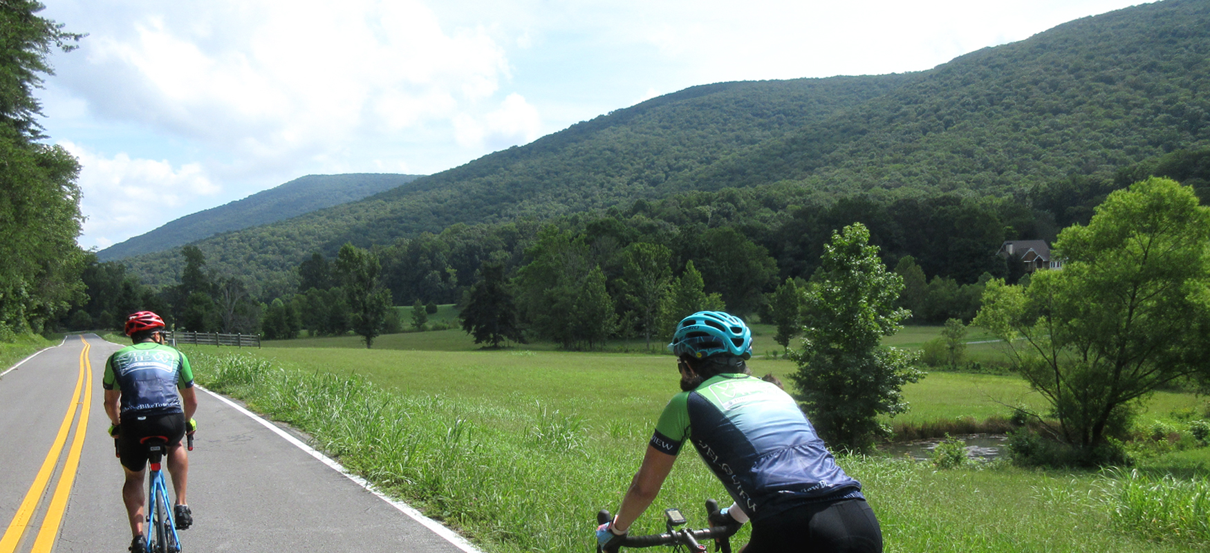
While Shook starts off as a pleasant little farm road, it leads right into a short but steep climb. Keep your speed in check as you descend down the other side of the climb, as the road ends abruptly at a stop sign at the bottom of the hill. Take a left at the stop sign onto Back Valley Road and enjoy the gorgeous views of Lookout Mountain to your right. (Keep one eye on the pavement though, as there are some rough spots along this stretch.)
A mile after turning onto Back Valley Road, turn right again onto Fricks Gap Road, which will keep you running parallel to the ridge with even more beautiful views of the mountain. About half a mile later, Fricks Gap drops down a fun little descent that ends at a stop sign. Turn left at the stop sign onto Harold Stevens Road and follow it for a mile until it ends at a stop sign at 193.
Turn right onto 193 and ride single file for the next half mile before turning right onto Cove Road. Be sure to check out the sign at the intersection welcoming you to the Cove. It lists all of the farms in the area and makes for a nice photo op.
After two miles on Cove Road, you'll turn right onto Tatum Road and head straight towards the base of the mountain. This turn comes up quickly as you crest a small hill, so be on the lookout for it. (There's a yellow school bus stop sign right before you get to the turn.)
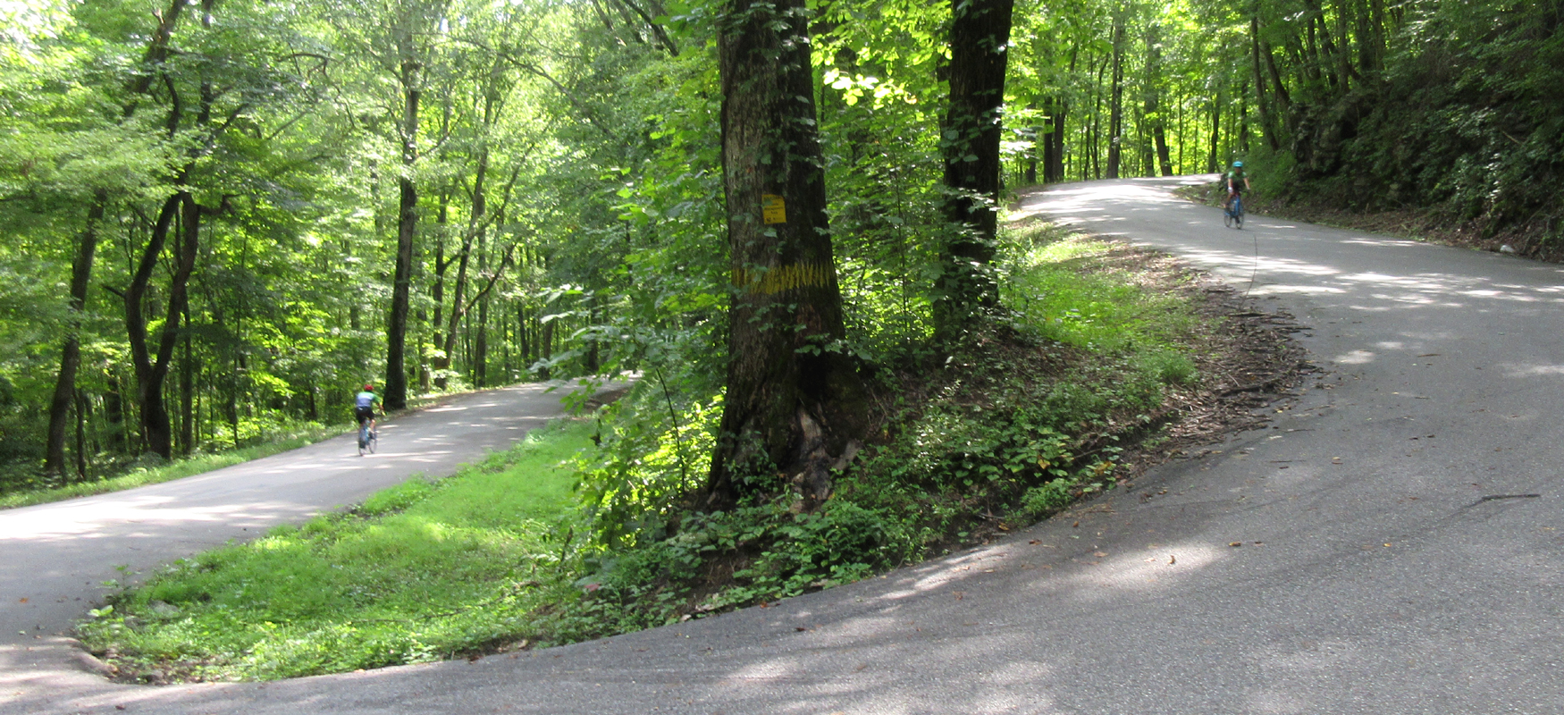
Tatum is a fun tree-covered road that gives you a nice change of pace from the wide-open farmland that is the hallmark of this ride. The road starts with a straight shot to the base of the mountain and then bends left and runs parallel to it. There are a few openings in the trees that let you know how close you are to Lookout Mountain and give you some great views of the escarpment at the top of the ridge. The other great thing about this road is that once you come over the top of the initial climb (it's not too long), the rest of it is pretty much a gentle downhill, which makes the smooth pavement and easy curves a blast to ride!
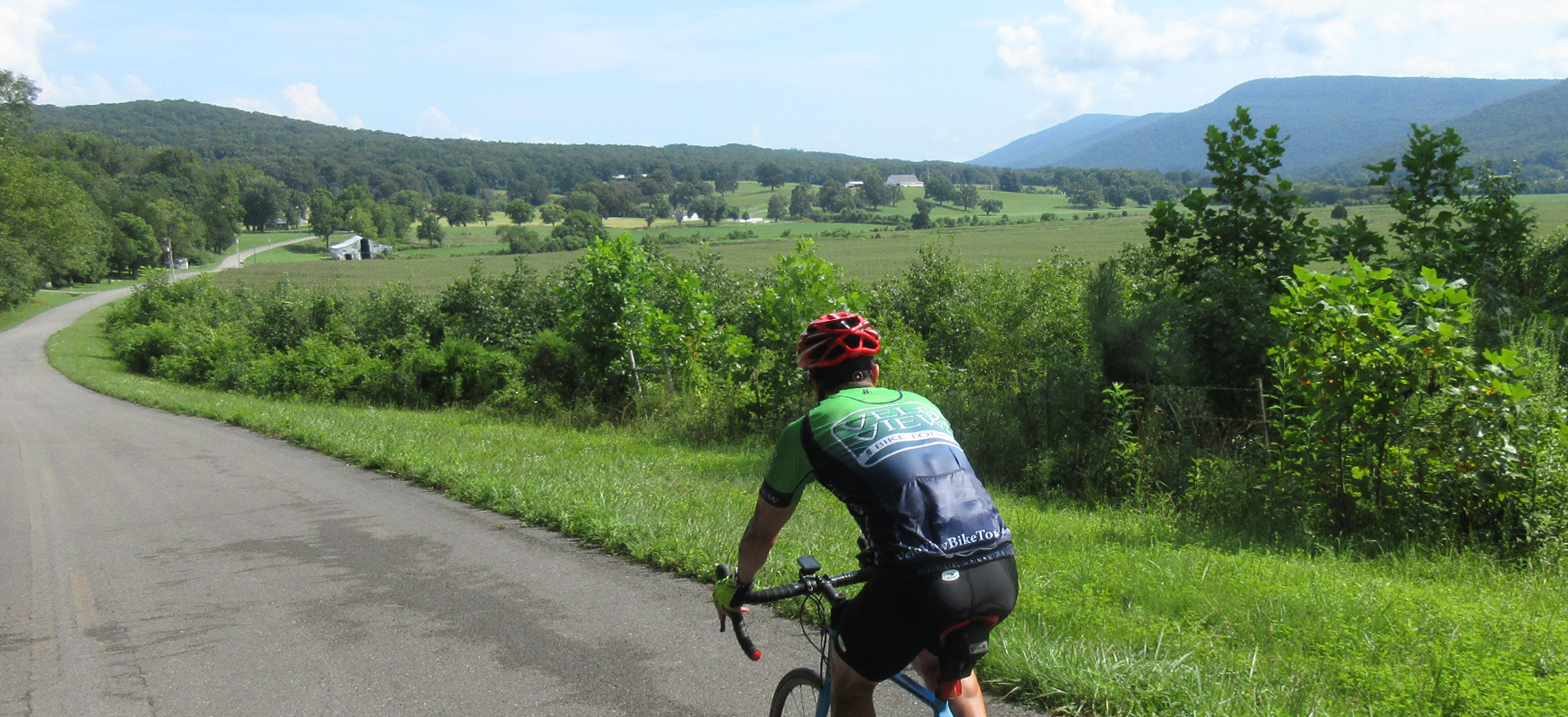
Two and a half miles after turning onto Tatum Road, it will bend to the left again and turn away from the mountain. The road actually changes names to Crow Gap Road, but you probably won't even notice. What you will notice is that it goes uphill! After coming over the top of the short climb, the road will drop down and bring you back to Cove Road, where you'll turn right and continue heading south.
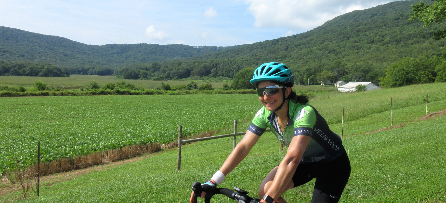
From this point, it's pretty much a straight shot to the heart of the cove, with stunning scenery on both sides of the road, with Lookout Mountain on your right and Pigeon Mountain on your left. You may notice that the farther you ride south, the closer the two mountains get to each other. Where they come together is where the cove ends and where you'll head back north. But before you get to that point, you've got to get over a half-mile climb that doesn't look like much but will have you feeling your legs by the time you crest it!
After coming over the top of the climb, you'll be rewarded with a fun downhill that takes you all the way down to the pit stop in the heart of the cove. Stay to the right as you start this descent and you'll pass through a tree-lined section that will have you thinking you're riding in Europe! After passing under the trees you'll drop down into Mountain Cove Farms Resort, which is owned by Walker County and offers camping, cabins and event space. It's a beautiful location for any occasion, and it's also where you'll enjoy a pit stop at the Mountain Cove General store, which will be on your right at Mile 23.6. There's a picnic table and some bike stands in a grassy yard in front of the store where you can relax and stretch after grabbing some snacks and drinks inside. Restrooms are available in the pavilion next door to the general store.
If you're doing the full route and taking on the Dougherty Gap climb, you might consider saving your break until after the climb so that your legs don't get cold before going up the hill. To do the climb, just continue south on the road. While it starts to go uphill shortly after passing the rest stop, the climb doesn't really start until about a mile down the road. You'll know you're officially on it when the road bends sharply to the left and the grade tilts up dramatically! It's a beautiful tree-lined climb with numerous switchbacks so take your time and enjoy the scenery. Be advised that the climb gets harder the farther you go, so pace yourself at the beginning and save your legs for the top of the climb where the grade stays in the mid to upper teens. From the lefthand bend to the top of the climb is a little over a mile. Once at the top you'll be greeted by a straight, tree-lined road that you can roll down to stretch out the legs. At the stop sign at the end of this road (less than half a mile), turn around and cautiously descend back down to the general store. The switchbacks come up quickly on the descent, so make sure you scrub your speed before you get into the curves.
After the climb and pit stop, head back out the way you came in, which will involve a very short but very steep climb back up to the tree-lined section, guaranteed to wake the legs back up after your break! After passing under the tree-lined section, veer to the right onto Hog Jowl Road. In addition to having one of the best road names out there, this road also offers some incredible scenery riding along the base of Pigeon Mountain, as well as some really fun rollers that trend downhill. It's a truly spectacular section of roadway that sets this ride apart!
Eventually the fun rollers will give way to a few short steep pitches and the scenery will open back up into wide-open farmland with views of Lookout Mountain on your left and Pigeon Mountain on your right. Five and a half miles after leaving the general store, you'll come to a stop sign. Turn right to stay on Hog Jowl and continue north towards the Pigeon Mountain Grill. That's the last turn of the ride, and from that stop sign it's only 4.5 miles to the finish, which always seems to arrive right as you're getting hungry for lunch! Before you get to the four-way stop where the Pigeon Mountain Grill sits, be sure to look for "Saul to Paul" farm on your left. The Grill actually offers burgers using beef from that farm!
When you reach the four-way stop at the end of Hog Jowl Road, use caution entering the parking lot of the Pigeon Mountain Grill. It's all unpaved and the gravel can be thick in some places. So take your time and enjoy your well-earned post-ride lunch!