32 Miles / 2500 Feet of Climbing
A scenic tour of the rolling farm roads on the Cumberland Plateau and beautiful Fall Creek Falls State Park.
Potential Route Modifications: This route is really two routes combined into one ride, with the first part heading out of the park (23 miles), and the second part touring the roads inside the park (19 miles). So doing one without the other significantly reduces the mileage. You can also make the ride inside the park shorter by skipping the loop that goes over to the lodge and only doing the Scenic Loop, which reduces the mileage by a little over 2 miles. You can also add a little mileage by detouring into the campground and cabin areas.
Fall Creek Falls State Park is Tennessee’s most visited state park, and for good reason, with several beautiful waterfalls (including the park’s stunning 256-foot namesake waterfall) and 30,000 acres of beautiful wilderness to explore. The countryside beyond the park’s borders is also quite scenic, giving cyclists the option of riding both inside and outside the park. Because of the popularity of this park, you will need to pick your ride time carefully to avoid peak traffic times. Riding early in the morning and on weekdays is your best bet to avoid the crowds. Weekends in the summer can be packed!
The ride can be started anywhere in Fall Creek Falls State Park, but we picked the Taft Village & Snack Bar area, as it is centrally located and is a good place to park if you're just driving over for the day. Clean restrooms and a water fountain for filling up your bottles are located nearby.
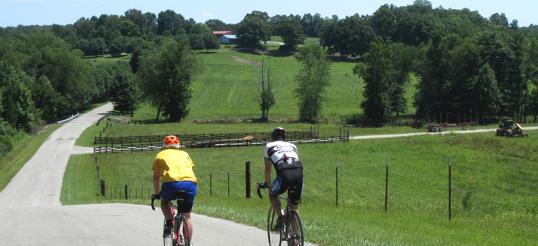
If you’re doing the full route that includes the loop outside of the park, you'll head out on Lakeside Road, which will take you up to Village Camp Road in about a quarter-mile, where you’ll take a left. This is a winding road with some steep descents early on, so watch your speed heading downhill to ensure that you can negotiate the curves. Sadly, what goes down must also go up, and you'll soon be faced with a long (and in places very steep) climb out of the park. The road will also change names to Park Road. As this is one of the main roads in and out of the park, you may encounter a few vehicles, so stay to the right side of the road at all times.
Around Mile 3.5, you'll turn right onto Groves Road, and a couple of miles later, you'll turn right again, this time onto Deweese Road. Deweese Road soon changes names to Old Spencer Road, and the scenery will open up to some beautiful expansive rural landscapes. Old Spencer comes to an intersection with Watson Loop where neither road has a stop sign (or at least there wasn’t one the last time we rode this route). You’ll still want to stop or at least proceed with caution as you turn left, which is actually staying on Old Spencer Road. Shortly after turning left, look for a right turn, which is also just staying on Old Spencer Road. These two intersections are a little odd, but it will make more sense when you’re there in person. All the same, you’ll want to pay attention when you get to this intersection.
After making it through this left/right jog, Old Spencer will take you through some tree-lined miles, which is a nice change of pace from the wide-open scenery you’ve been riding in. Around Mile 10.5 keep an eye out for Pleasant Grove Church on the right side of the road. You'll take a right here, onto Griffith Road. Because Griffith Road has no street sign, and because you'll be going downhill fast as you reach it, you'll want to look for the church as your cue to turn.
Griffith Road starts off with a short climb followed by a more substantial climb about a mile later. As the road levels off after this second climb look for Watson Loop on your right. It can sneak up on you, as it comes on a curve in the road.
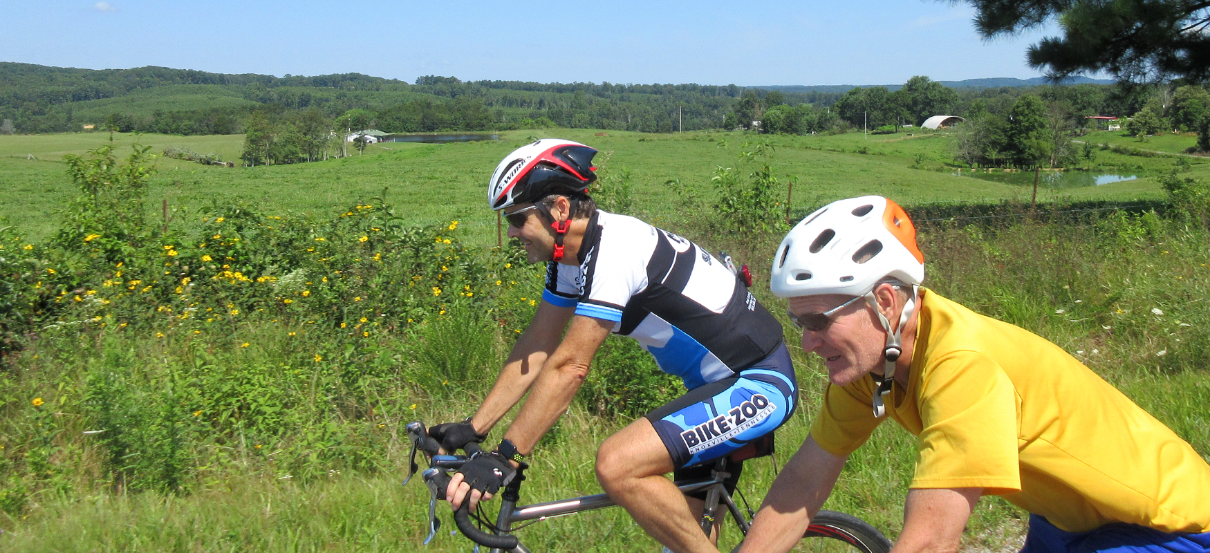
Watson Loop is our least favorite part of this ride, offering little in the way of scenery as you roll through a rural neighborhood. You'll only be on it for about a mile and half though before you turn left onto Cotter Road. (The route map identifies this road as Huey Watson Road, but the street sign says Cotter Road.) Almost immediately after turning onto this little road, veer to the right onto Dyer Road, which is even smaller and will feel more like a driveway. It’s a great little road with beautiful scenery off to your left. Although you’ll start off with some not-so-scenic houses on the right side of the road after you first turn onto Dyer, the residences will disappear after a bit and you’ll be left with nothing but rural goodness.
Dyer brings you back to Old Spencer Road a little over a mile later, where you’ll turn left and head back the way you came. Despite being on this road a short while ago, Old Spencer will have a different feel in this direction as you ride towards a hilly tree-covered terrain rather than the wide-open views you had on the way out.
Keep an eye out for Groves Road around mile 17. You’ll know you’re getting close to the turn when you head up a small hill with a beautiful pond off to your right. Shortly after passing this pond, you’ll see Groves on the left.
Groves Road is more fun in this direction as this roller coaster of a road has more down than up heading back towards the park. The same holds true when you reach the end of Groves Road and turn left onto Park Road. You’ll still have a few rises on the way back to the park, but the majority of this road is downhill, which gets pretty steep and curvy after you reenter the park. Have fun with this part, but watch your speed on the curves.
You should also be prepared to head back uphill after crossing Rockhouse Creek a little after mile 21. You can carry some momentum onto this short but steep climb, but you’ll want to gear down quickly to avoid stalling out.
After you crest the hill, you’ll have another fun descent which will take you across Cane Creek. There’s a nice pullout and picnic area in the bend of the creek off to your left. (You may have missed it on the way out as you will have had some speed in this spot coming from the other direction.) As you make your way past this bend, gear down and brace yourself for a proper wall, as the road tilts up sharply with grades in the mid to upper teens! The steep part lets up before too long, but you’ll still be pedaling uphill for close to a mile as you make your way back to Lakeside Road, which will show up on your right shortly after mile 22.
After turning onto Lakeside Road, you’ll enjoy a nice descent as you roll down to Fall Creek Falls Lake. This is a scenic spot and you may want to stop for a picture. Just make sure you pull completely off the road if you decide to stop.
Immediately after crossing the dam that forms the lake, you’ll see a sign for a bike path heading to Fall Creek Falls on the right. There’s also a bike path heading to the park’s lodge on the left. Unless traffic on Lakeside Road is unbearable, we recommend staying on the road rather than hopping on the bike path. The bike path to Fall Creek Falls is nice and wooded, but it can also be congested with pedestrian traffic and is a little sketchy in places.
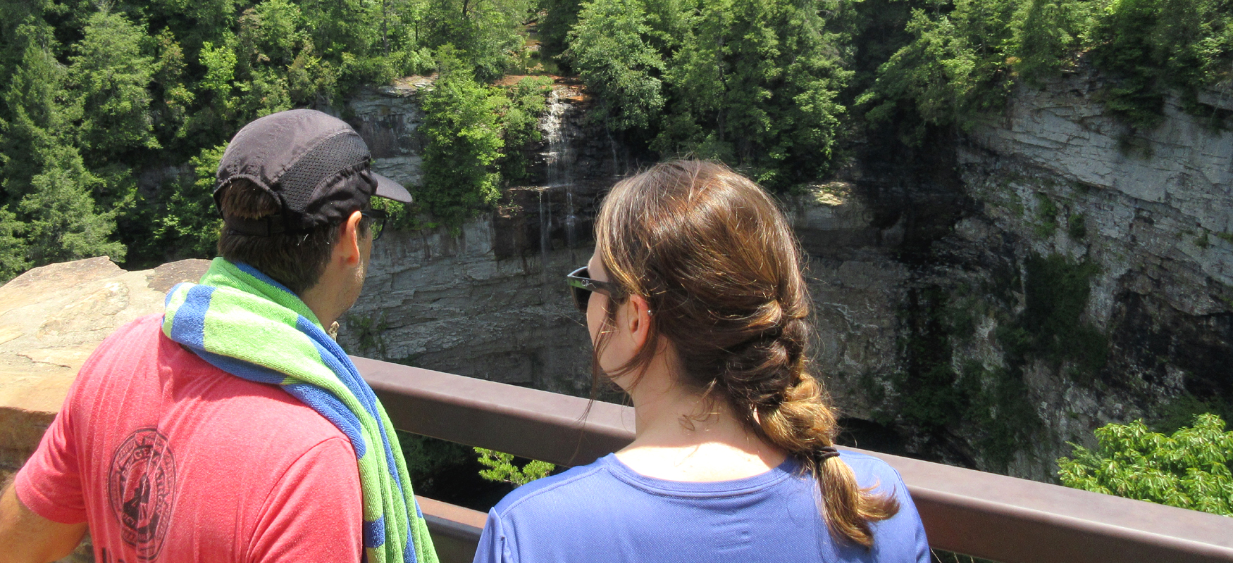
While staying on the road will allow you to continue to pedal at a reasonable pace, it also means heading uphill for about a mile before reaching Scenic Loop Road on your right. The initial grade coming up from the lake is tough but it tapers off quickly and is plenty manageable after that. And once you turn on Scenic Loop Road you’ll be rolling downhill pretty much all the way to Fall Creek Falls. (Bear right when you come to a split in the road a half-mile after turning onto Scenic Loop Road.) When you reach the parking lot for the Fall Creek Falls trailhead, follow the signs to the overlook, which will be straight ahead. The overlook offers a super scenic look at this enormous waterfall and you will definitely want to take a few shots before moving on.
After taking in the view, continue on Scenic Loop Road for another three and a half miles. It’s a great ride with a few more scenic overlooks. Expect to do a little work on this loop, as there are some ups and downs as you make your way through the woods. Also be considerate of vehicles behind you. A good portion of the loop is a one-lane, one-way drive, so take advantage of pull-outs to let vehicles come around you. At mile 28.3, you’ll come to a stop sign and have the option of turning right towards Piney Creek Falls or left to continue on the Scenic Loop. We recommend skipping the short ride to Piney Creek Falls since the overlook is down a little path that is impossible to ride and challenging to walk with a bike. In other words, taking the turn to Piney Creek Falls amounts to nothing more than a short ride to a dead-end parking lot.
From that stop sign, it’s another mile on Scenic Loop Road before you return to Lakeside Road. (Be sure to veer right at the split in the road at mile 28.6.) Turn right on Lakeside Road and pedal a mile over to the lodge. The lodge is new and is an excellent place not only to base your adventures out of, but it’s also a great place to eat, with a nice restaurant overlooking the lake. If you’re looking for something more than the Snack Bar has to offer, you might consider starting and finishing your ride here so you can enjoy a proper post-ride meal.
If you’re not using the lodge as your start/finish, then you’ll need to make your way back to the other side of the lake. There are two ways to do that. You can pedal back up the hill on Lakeside Road and follow it all the way back, or if you’re feeling a little adventurous you can take the sidewalk from the lodge down to the lakeside path and follow it a mile and a half until it ends at Lakeside Road near the dam. This is a beautiful and flat option as you pedal along the edge of the lake. The only downside to this little path is that it is very bumpy, with numerous places where the tree roots have pushed the concrete up to create a series of annoying speed bumps. If you don’t mind the bumps, we recommend taking this route as it offers a unique way to experience the lake.
When the path ends at Lakeside Road, turn right and pedal up the hill from the lake on the shoulder of Lakeside Road about half a mile and then turn right again to reach the parking lot where you started.
Once back to your car, you can grab some food at the Snack Bar and refuel at a picnic table, or better yet head over to the lodge for something more substantial. While there is a nice swimming pool next to the Snack Bar, consider heading over to the Fall Creek Falls trailhead and hiking down (a third of a mile) to the natural pool at the base of the falls. It's a refreshing way to cool off after a fun ride on the Cumberland Plateau!