42 Miles / 1700 Feet of Climbing
Take in the beautiful scenery of the upper Sequatchie Valley on this 42-mile ride between Dunlap and Pikeville.
PLEASE NOTE: McWilliams Road has been resurfaced with loose gravel, which will compact over time, but is still hazardous as of May 2022.
Potential Route Modifications: This route can be shortened to 24 miles by turning right (east) on College Station Cross Road and then looping back to the ride start on East Valley Road.
This ride offers spectacular views of the Sequatchie Valley on low traffic roads between Dunlap and Pikeville, and it finishes with good Southern cooking and amazing pies at the Cookie Jar Cafe!
Parking at the Cookie Jar Cafe will not only set you up for a great post-ride meal, but it will also start you off with one of the best views in the Valley overlooking the dairy farm that has been in the family for over 150 years! They also have a petting zoo if you'd like to experience the farm up close and personal. (If the restaurant isn't open when you arrive, you can find a bathroom behind the restaurant.)
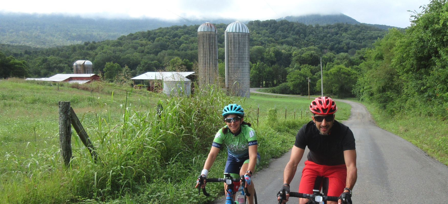
Take a left onto Kelly Cross Road from the Cookie Jar Cafe driveway, and then another left onto East Valley Road which will have you heading north towards Pikeville. Rather than staying on East Valley Road all the way to Pikeville, you’ll cut across the middle of the valley on McWilliams Road. This will be a left turn at Mile 3.5. The road is frequently missing a street sign so keep an eye on your odometer. (There are several grain silos near this intersection that serve as a landmark for where to turn.)
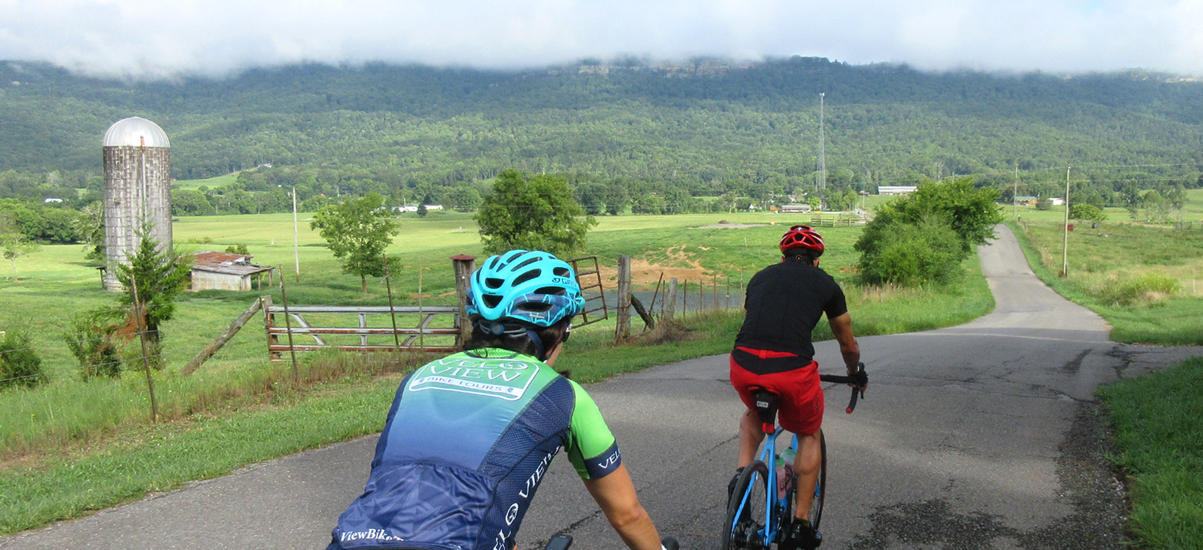
McWilliams Road has some spectacular views of the Valley in all directions, but it also has a few short climbs, so be prepared to gear down after you turn off of East Valley Road. Also be mindful of potholes and rough pavement on this road, especially descending the back half of the road. Be very cautious on the descent as it is fairly steep and quite bumpy! It’s well worth the jostling though as the descent leads to a fantastic stretch of road with great views both in front of you and looking back over your shoulder. Definitely photo-worthy scenery!
Follow McWilliams Road across Highway 28 until it “T’s” into Old State Highway 28, which is a lightly traveled road that runs north-south on the west side of the valley. You’ll take a right onto this road, which will run you north about 13 miles all the way to Pikeville. The pavement starts off a little rough, but improves the farther north you ride. It’s a beautiful stretch of road with some shaded tree-lined sections mixed in with great views of the rocky escarpments along the top of the ridge that forms the west side of the valley (the Cumberland Plateau)
Old State Highway 28 eventually runs into the new Highway 28 at a stop sign. This can be a tricky crossing with five lanes to cross and no traffic signal. However, traffic is not particularly heavy in this part of the valley, and by using the middle turn lane you should have no problem crossing over and getting onto Main Street. Rather than taking Main Street all the way into town, take your first left onto Sequatchie Road and follow that road until you reach the Exxon station. This is a great place to refuel with plenty of snacks and drinks, as well as clean restrooms.
After the pit stop at the Exxon, you’ll roll down Cleveland Street to downtown Pikeville. Pikeville was established in 1816 as the county seat of Bledsoe County. Pikeville is believed to have been named for the early American explorer Zebulon Pike, for whom Pike’s Peak in Colorado was named. Because Highway 28 bypasses downtown, Main Street has been able to retain many historic buildings and has a small-town charm worth exploring.
The centerpiece of the downtown is the handsome 1911 County Courthouse, which sits directly across from the historic commercial row on Main Street. Next door to the courthouse is Veterans Park (paying tribute to Bledsoe County veterans) and the the farmers market pavilion, which is usually bustling with activity Tuesday afternoons and Saturday mornings during the growing season.
If you’re into historic homes, ride a short distance down Main Street (just south of the bike route’s turn onto Cumberland Avenue) and you’ll find some real gems, including the White Wagon Bed & Breakfast. Also check out the old 1850’s jail building a couple of blocks away at the intersection of Frazier Street and Cranwell Street. (It’s now the Bledose County Veterans Service Office.)
For more information about the history of Bledsoe County, click here.
If you’re taking a leisurely pace and the timing is right, consider stopping for lunch or maybe pop in for a mid-ride treat at Ember's Ice Cream Shoppe!
After checking out Pikeville, you’ll leave town heading east on Cumberland Avenue. On your left, just after passing the farmers market pavilion, is the historic Ross House, which used to be the town's hospital and now houses a medical museum. And on your right, just after crossing the Sequatchie River, is a church dating back to 1870 that once served as the Freedmen's Bureau school and church.
After passing the church, the road goes right into a climb. It’s not too long though, and shortly after you crest the top you’ll take a right on Old Dayton Road. This road does not have a street sign so be looking for it. The turn is less than a mile after leaving Pikeville and it’s just as you’re coming down the other side of the climb when the road bends to the left.
Old Dayton Road has some rough pavement, but it’s a very quiet road with some nice views as it turns south and takes you to Highway 30. You’ll go straight across Highway 30 onto another small farm road called Wesley Chapel Road. While this road does have some punchy climbs and a few potholes, the reward for the bumps is a commanding view of the Valley from up on the little ridge that the road runs along. Be ready with the camera!
Wesley Chapel Road eventually runs down to East Valley Road, where you’ll take a left and head south back towards the Cookie Jar Cafe. For the next 15 miles, you’ll enjoy smooth pavement, plenty of rollers, and wonderful Sequatchie Valley views!
As you near the end of this long run along East Valley Road, you’ll have two options. If you’re ready for the ride to end, you can shave off a couple of miles from the route by turning onto Kelly Cross Road and going directly to the Cookie Jar Cafe. The other option is to continue straight on East Valley Road past Kelly Cross Road and turn on Old Mill Road instead. This second option is the way the route is designed because Old Mill Road makes for a great finish, with its curvy farm road scenery and rural charm. Old Mill Road eventually bends north and ends directly across from the Cookie Jar Cafe driveway. From there it’s back to the car and onto the restaurant for a well-earned post-ride meal!