40 Miles / 2500 Feet of Climbing
The signature ride out of downtown Dayton, this route combines a beautiful 3.5 mile wooded climb with wide open rolling farmland. BONUS: It ends at a brewery!
Potential Route Modifications: This route can be shortened to 32 miles and 2300 feet of climbing by skipping Cranmore Cove Road/303 and continuing down Hwy 30 and turning right onto 2nd Avenue which leads straight into downtown.
This is one of our favorite rides out of Dayton, as it combines a big wooded climb with some wide-open rural farmland scenery. It's a challenging ride but not overly long. Highly recommended!
Another reason we love this ride is that it starts & finishes at Monkey Town Brewing Company, which offers a wide variety of tasty craft beer along with an excellent lunch & dinner menu.
There's a free parking lot directly across from the brewery, and there's plenty of on-street parking as well. If you're up for checking out the shops on Market Street or the Scopes Trial Museum, you can also park in front of the Rhea County Courthouse, just a block away from the brewery. And of course there are a number of other great restaurants downtown as well!
You'll leave downtown heading west on Market Street. Immediately after crossing the bridge over Richland Creek, turn right onto Hickory Street, followed by another right turn onto California Ave. Use caution on California Avenue as there are a couple of railroad crossings. California Avenue will bring you to an intersection with Delaware Avenue where you'll continue straight on California. This next stretch on California offers some nice views of Lone Mountain off to the right.
After a quarter mile, California will come to a "T" intersection with Illinois Avenue where you'll turn right and follow it up and around a sharp left curve. The street name will change to Old Graysville Road at this point, but it's the same road. For the next four miles, you'll stay on Old Graysville and let the rolling hills warm up your legs for the climb ahead!
After crossing over Sale Creek, you'll turn right onto Cranmore Cove Road/303, and then almost immediately turn left onto Long Street, which will run you through a residential area a little less than a mile before intersecting with Pikeville Avenue.
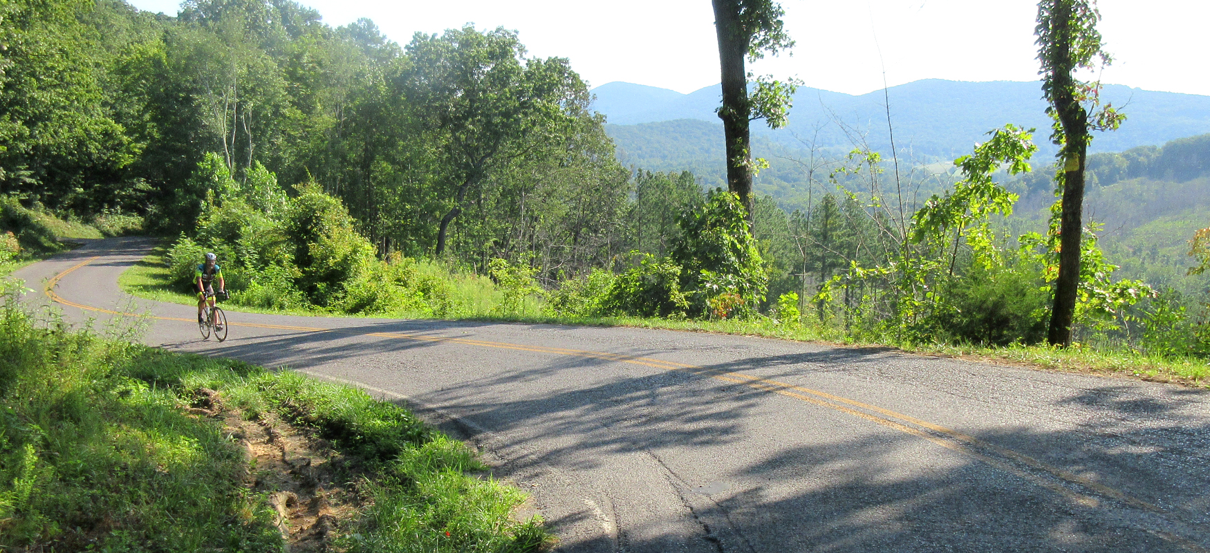
You'll turn right onto Pikeville Avenue and start to head uphill. The grade is easy at first, but when the road bends to the left the grades kick up dramatically. (The street name also changes to Brayton Mountain Road at this point.) These initial double-digit grades will subside after a while, and you'll also start to get some nice views off to your left. After the first mile, you'll hit a switchback to the right which takes the road into a beautiful wooded section with more moderate grades. This section is interrupted less than a mile later with a couple of switchbacks that kick up close to 20%!
After clearing those switchbacks, you'll have just under a mile of steady climbing before the grades let up and the road levels off. Be advised that this is just a break in the climb (definitely a false summit!), so be prepared for one last push to the top after this level spot. From the first steep grade (where Brayton Mountain Road starts) to the true top is about 3.5 miles. It's a great climb and a solid challenge!
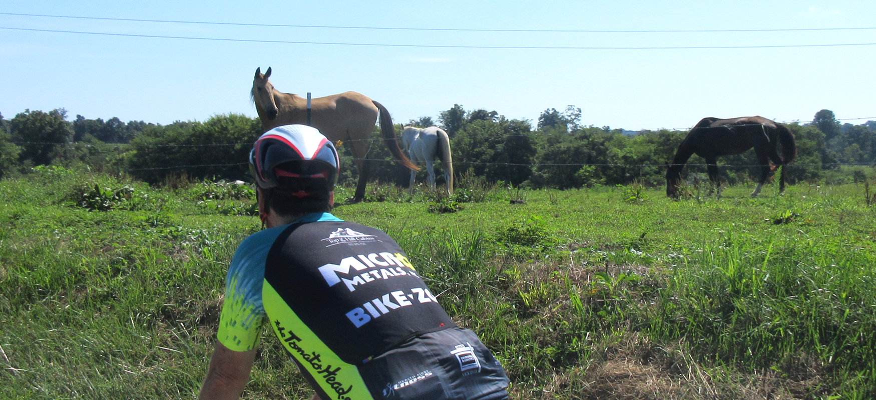
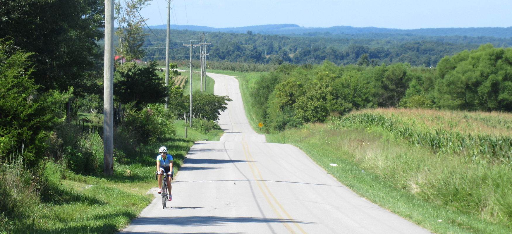
Once you reach the top, the trees will open up and the landscape will look more agricultural with a smattering of rural houses in between farms. The road has some rolling hills along this stretch, but compared to the big climb you just finished, this stretch will feel pretty easy.
Be sure to veer to the right around mile 14.4 (less than four miles after cresting the climb) which will put you on New Harmony Road. A couple of miles after veering onto New Harmony Road, you'll enjoy a sustained descent that unfortunately leads right into a short but brutally steep climb!
At the top of the climb (which is around a quarter-mile long) is Phillip Wooden & Sons Farm Market, which is a great place to take a break. They have plenty of beverages on hand, and they also have a small restaurant if you want to take a lunch break (or just grab some cookies!). And of course they have a huge selection of seasonal produce.
After refueling at the farm market, you'll continue on New Harmony for another mile before turning right onto Ogden Road. Ogden Road will take you through more farmland and rural residential areas with a number of twists and turns before eventually ending at a "T" intersection with Hwy 30.
Hwy 30 has fast traffic and can be busy at times, so use caution when turning onto it and be sure to stay in the protected shoulder and off the main road. Because the shoulder may have debris on it, keep your speed in check as you make the descent in case you need to avoid any road hazards. Hwy 30 can be a fun descent (no pedaling required!), but you need to use caution and be aware of your surroundings at all times.
About 2.5 miles after turning onto Hwy 30, you'll come to an intersection with Cranmore Cove Road/303 on your right. If you're in a hurry to finish or simply don't want any extra miles, you can continue down Hwy 30 back to Dayton (as noted above as a potential modification of the route). Otherwise, turn right onto Cranmore Cove Rd/303.
Cranmore Cove initially continues the fast descent before leveling off and tilting up for a short bit. But before too long you'll be rolling down again. It's a fun road with great scenery and nice views of Lone Mountain off to your left.
Cranmore Cove ends at a stop sign at Dayton Ave/Old Graysville Road, where you'll turn left. This should look familiar to you from the beginning of the ride. Just as Old Graysville served as a good warm-up for the big climb, consider it the cool-down phase of the ride as you roll back to Dayton retracing your steps to downtown, where good food and recovery beverages await!