10 Miles / 400 Feet of Climbing
One of the most popular routes with local cyclists, this in-town loop combines a manageable climb with one of the few flat roads in the Chattanooga region.
Potential Route Modifications: Because this route is short, it is typically ridden as a number of loops using Riverside Ave and Whitehall Rd as the turning point in the loop. To avoid the Whitehall climb, you can use Hamm Road to create a loop that is relatively flat.
We've chosen Outdoor Chattanooga as our starting & finishing point, but 2 North Shore (Whole Foods) is another good option that avoids Frazier Avenue and intersects the route using Manufacturers Road.
From Outdoor Chattanooga, roll over to Tremont Street and take it up to the traffic light at Frazier Avenue. Take a left on Frazier and ride in the right lane. Continue straight through the traffic light at Market Street (Frazier will change names to Cherokee Blvd at this point) and also straight through the light at Manufacturers Road. After crossing Manufacturers Road, start to look for an opening to slide into the left lane, as you'll need to take a left at the next intersection, which is Manning Street.
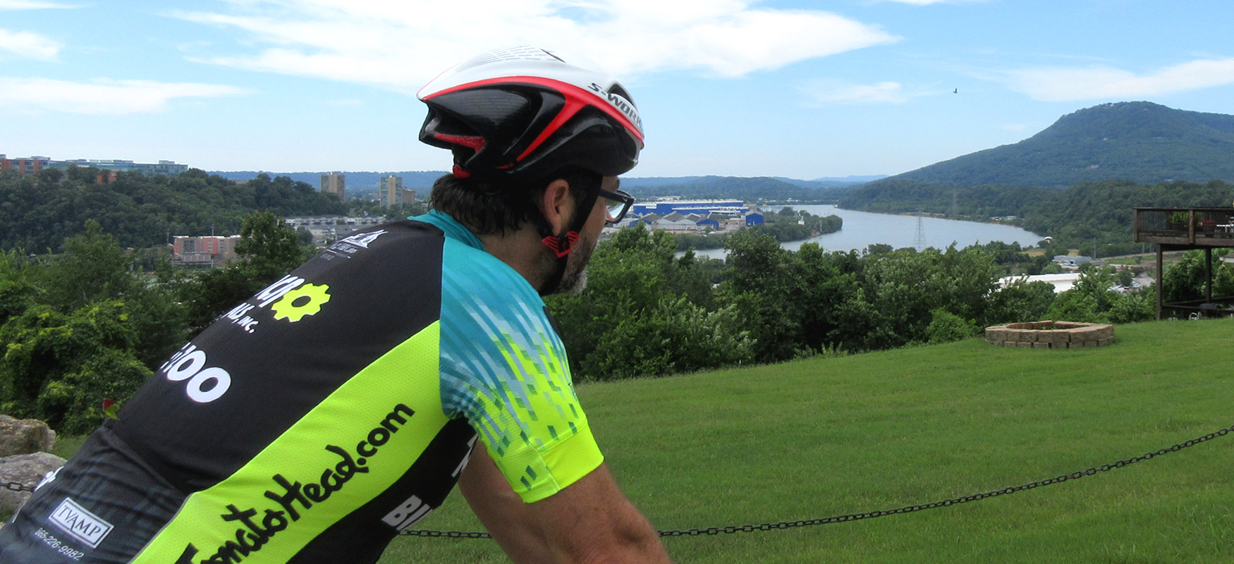
After taking a left on Manning Street, follow it as it goes under Hwy 27 and changes names to Whitehall Road. Veer right after passing under Hwy 27 to stay on Whitehall and follow it up a nice climb with a reasonable grade. Towards the top of the climb, the road comes to a stop sign. Turn right here to stay on Whitehall and continue the climb, and then take your first right onto Walsh Road. You'll still be climbing on Walsh, but you'll also get to enjoy some nice views overlooking the Tennessee River and downtown Chattanooga.
After a short run, Walsh rejoins Whitehall Road, where you'll turn right and enjoy an easier grade before making one final push to crest the climb. After hitting the top, the road will bend to the left and drop straight down. Keep your speed in check on the way down, as you'll need to yield to traffic before turning left onto West Elmwood Drive at the bottom of the hill.
Follow West Elmwood half a mile and then do a quick right/left jog using Wayne Avenue to cross the over the train tracks and continue on East Elmwood, which runs parallel to West Elmwood on the other side of the tracks. East Elmwood will take you down to Pineville Road where you'll turn left and go straight for the next 2.5 miles.
This 2.5-mile stretch is the main appeal of this route, as it offers a relatively flat straight area to ride. After the first quarter-mile or so on Pineville, it will change names to Moccasin Bend Road as it passes by the intersection with Manufacturers Road. Shortly after, you'll come to a four-way stop with Hamm Road. Watch for truck traffic at at this intersection as you continue straight.
About this point in the ride, you may notice a strong odor. This is coming from the wastewater treatment plant on your right. Consider this an incentive to pedal faster! (This section is also why the locals refer to this route as the "Poop Loop.")
After passing by the treatment plant, the scenery improves significantly with a golf course on your right followed by a nice wooded area. This natural area is the Moccasin Bend Archeological District, which is managed by the National Park Service and boasts continuous human habitation dating back 12,000 years! The area also played a role in the Civil War.
The 2.5-mile straight-away finally comes to an end at the Moccasin Bend Mental Health Institute. Just before you reach the gates to the institute, you'll see a small parking area to the right that you can use to turn around and head back the way you came on Moccasin Bend Road.
Continue straight through the four-way stop with Hamm Road and then take a right onto Manufacturers Road. This will put you on a short punchy hill that will require a little power. After cresting the hill, the road will start to head down and bend hard to the right. Just as it starts to bend, take a left (which will feel more like simply going straight) onto Riverside Avenue.
Riverside Avenue continues going down, and it's a fun little stretch to tuck in and pick up some real speed! The descent will bottom out sooner than you'd like and start to go uphill again. As it starts to rise, turn right into Compress Street. This is an easy road as it goes downhill and then flat, but keep an eye out for trucks as you pass through this industrial section.
Compress comes to a "T" intersection with Manufacturers Road, where you'll turn left. Stay to the right and follow Manufacturers across some train tracks (watch the angle on these tracks!) and through two traffic lights as you pass under Hwy 27. This stretch of Manufacturers Road is uncomfortable because of the traffic, but it won't last too long. Just stay to the right and hold your line.
After going straight at the light at 2 North Shore, take a right at the Renaissance Park entrance and then turn left to cut through the parking lot over to River Street. Turn right onto River Street and follow it as it goes under the Market Street Bridge and the Walnut Street Pedestrian Bridge before returning you to Outdoor Chattanooga.