38 Miles / 2500 Feet of Climbing
This route has all the ingredients for a great ride, with a pleasant warm-up, a long sustained climb, a fun descent, and a relaxing cool-down. It's a solid workout on some beautiful roads!
Potential Route Modifications: This route can be ridden in reverse, climbing Leggett Road and descending Retro Hughes.
You can start this route anywhere in Soddy Daisy, but we think the most convenient location is the North End Ballpark. There's plenty of parking there, along with public restrooms available next to a pavilion.
From the parking lot, take Depot Street to Hickman Street, turn left and then half a mile later turn right onto Walker Road. Walker Road will take you through a residential neighborhood for about three-quarters of a mile before ending at a stop sign at Back Valley Road.
Take a right on Back Valley Road and carefully make your way past the Hwy 111 on & off ramps. Once you clear Hwy 111, Back Valley should be lightly trafficked and you should be able to enjoy a relaxing warm-up. The road has two railroad crossings, but they run perpendicular to the road and shouldn't present any issues. The majority of the road is beautifully tree-lined with only one rise of any significance.
After three and a half miles on Back Valley Road, you'll come to a "T" intersection with Retro-Hughes Road where you'll turn left. After making this turn, you won't have another turn for the next 11 miles!
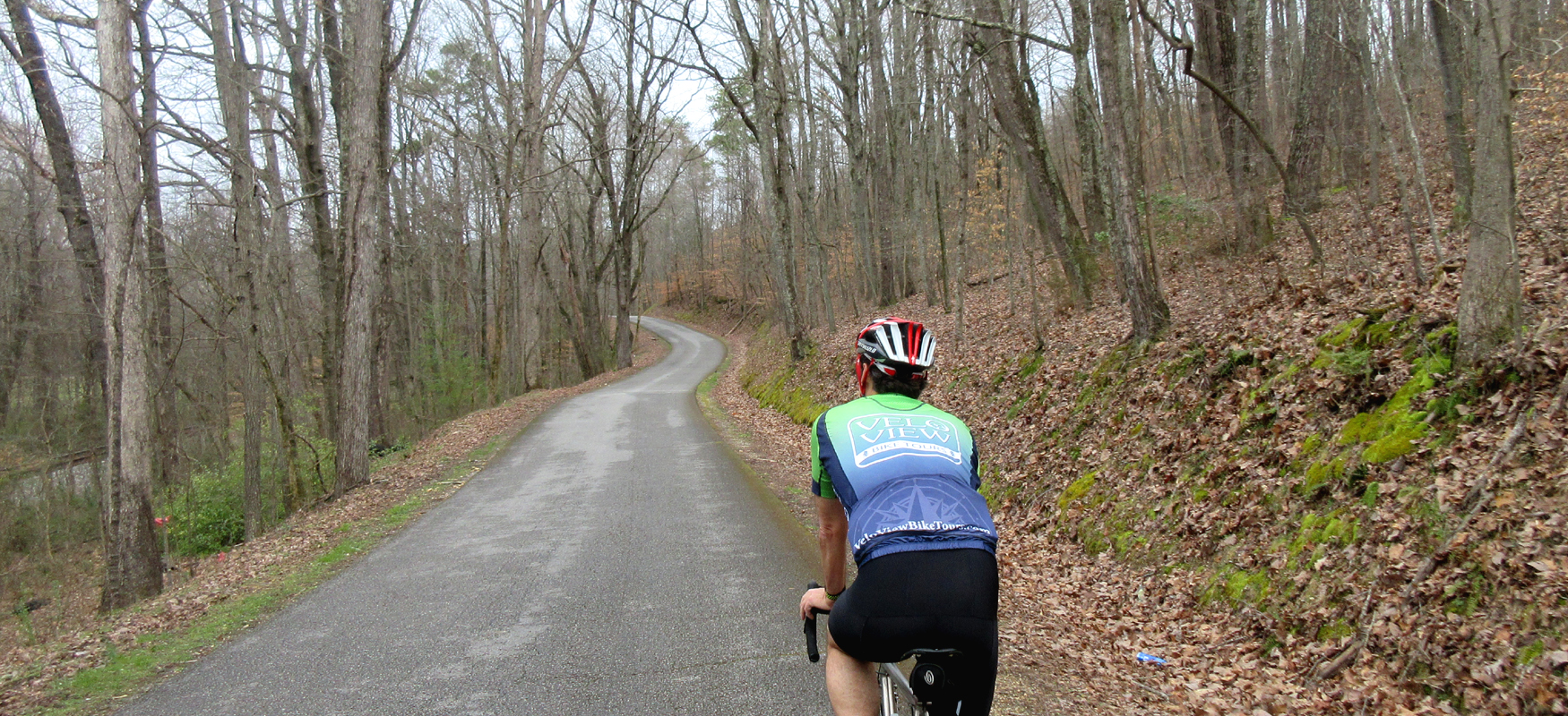
The first mile on Retro-Hughes is pretty easy, but after that there will be a very noticeable increase in grade, hovering around 10% for the next mile and a half. Despite the suffering, this is our favorite section of the climb due to the heavy woods.
This punishing section ends with a sharp lefthand bend in the road. The grade will come down and the landscape will change to mostly pine trees, with big sections of it cut down for pulp. Be advised that a lot of this land is owned by lumber companies, which means you may have an occasional lumber truck on the road. Traffic is generally light on Retro-Hughes, but you'll still want to keep an ear out for the big trucks.
The next mile and a half will be a series of ups & downs which will have you wondering if you finished the climb. Then you'll start another section of sustained climbing and realize you're not done after all! Fortunately, the grade isn't too bad and there are some breaks along the way.
We consider the climb to end around mile 11, although there isn't a significant landmark or vista to mark the occasion. But you will probably notice that you are no longer going up! In total, the climb is around 5 miles long (including the breaks).
About a mile and a half after the road levels off, you'll come to a little convenience store on your left called Last Chance Market. The name is appropriate because there really isn't anything else up there! So if you need food or hydration, you should probably stop in.
Another mile and a half after the market, Retro-Hughes comes to a "T" intersection with Hendon Road where you'll turn right. Hendon may have a few more cars than Retro-Hughes so stay to the right and be aware of your surroundings.
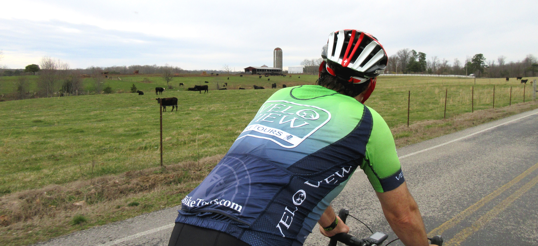
Hendon Road will take you past farmland and large-lot rural residences over the next five miles. For the most part it's just rolling terrain, but there is one notable descent and climb about four miles after turning onto Hendon Road. Both the descent and the climb are short, but they are very steep and you'll want to carry as much momentum as possible from the descent into the subsequent climb!
After you come up from this little roller coaster, look for a large farm on your left. It has a barn & silo and looks like a postcard. This is your cue that your turn is coming up. Around mile 21 you'll turn right onto Wishbone Road, which runs less than half a mile before ending at Leggett Road where you'll turn right.
Leggett Road is where the fun starts! Leggett is relatively flat for the first mile and a half, but then it starts to go down. The initial part of the descent is really a series of stairsteps, with some descending followed by flats (and a little up mixed in). These stairsteps go on for about four and a half miles before you finally reach the real descent.
You'll know you're reaching the fast part of the descent when you see signs warning of steep grades. This section lasts almost two miles and is a lot of fun. The pavement is smooth and the curves are not too sharp. Just know that there is a sharp lefthander towards the bottom that will require a significant reduction in speed. Pay attention to the warning sign on that one!
After you make the lefthand bend, the grade will come down and you can do some big-ring pedaling for another mile before turning right onto Back Valley Road (which is right after you cross the Rock Creek bridge).
About a quarter-mile after turning onto Back Valley Road, you'll come to a stop sign. Turn right to stay on Back Valley. This will put you on a series of short climbs & descents that may feel a little bigger than they are at this point in the ride. You shouldn't have too much traffic through this section, but there are a lot of blind curves so stay to the right side of the road just to be safe.
Two and a half miles after the stop sign, Back Valley Road will come to a "T" intersection with Retro-Hughes Road. You'll take a left here followed by a right turn to continue on Back Valley Road. At this point, the road should look familiar to you as you will simply be retracing your steps back to the ride start for the next five miles.
You'll know you're getting close to home when you go under Hwy 111. Just remember to take a left onto Walker Road as soon as you cross over the Soddy Creek bridge. From there it's an easy roll through the neighborhood back to the parking lot.