32 Miles / 900 Feet of Climbing
Chattanooga's Riverwalk is a car-free rec path that offers a pleasant and surprisingly diverse ride from the heart of town!
Potential Route Modifications: As essentially an out & back route with multiple access points, the Riverwalk can be shortened to any distance you'd like based on where you start. Skipping the south end of the Riverwalk (from Blue Goose Hollow to the Riverwalk's southern terminus at Saint Elmo Avenue) and simply going to the dam & back would reduce the route by 6 miles. Skipping the South Chickamauga Greenway detour would reduce the route by another 9 miles.
Spanning 13 miles from end to end, there are numerous places to start & finish on the Riverwalk. (Click here for a map showing all of the trailheads along with restroom locations, bike rentals, etc.) We've chosen the Blue Goose Trailhead as our starting & ending point since it is close to downtown and has free parking, clean restrooms, and bike-share rentals. It also makes a great location to explore the south end of the Riverwalk (a manageable 6-mile out & back ride).
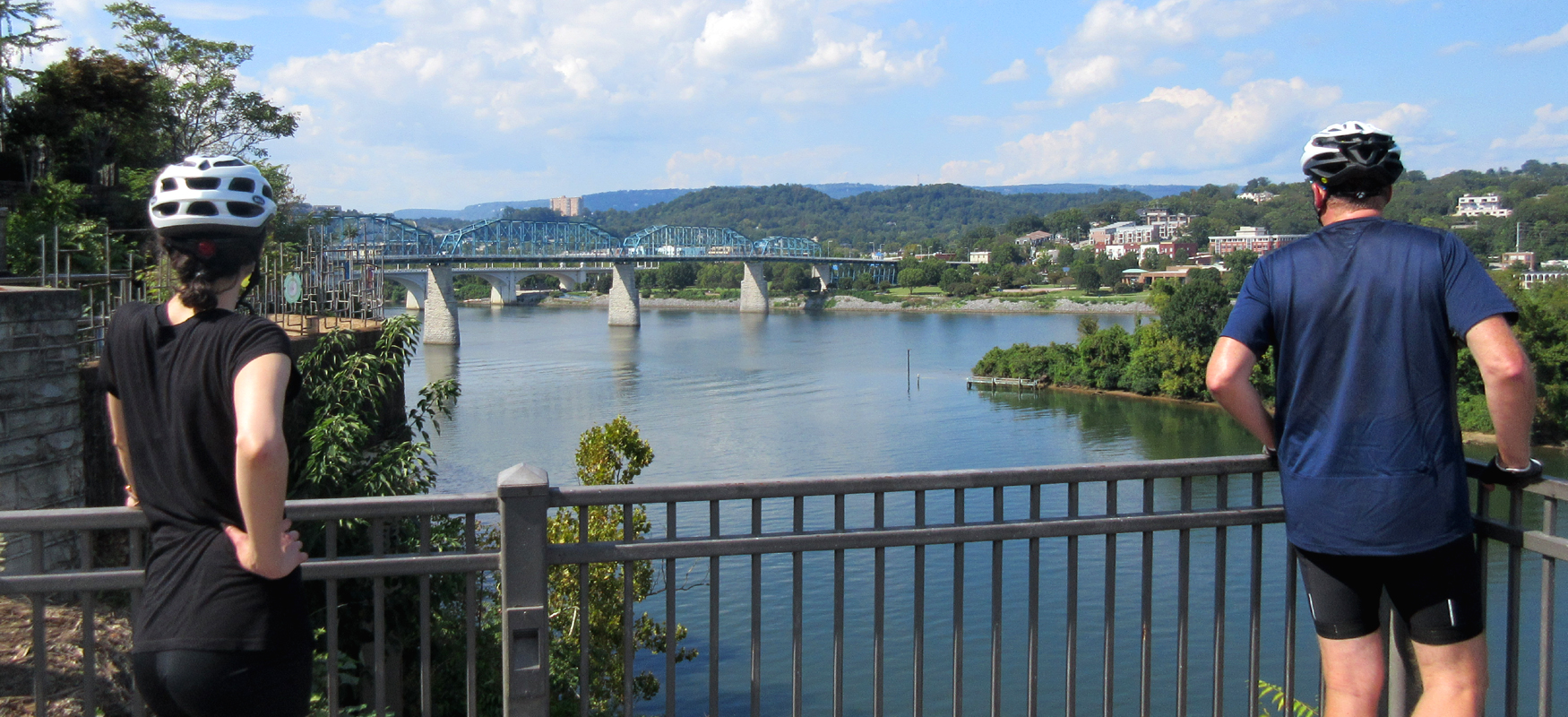
Our route includes this south end exploration, but first we ride north, heading from Blue Goose Hollow past the Cameron Harbor townhomes and boat dock to the SpringHill Suites hotel. After passing below the hotel and its parking lot, the bike path turns up to Riverfront Parkway and then runs parallel to the road as it passes by Ross's Landing. The landing is a nice wide open park at the heart of Chattanooga's Riverfront, offering sweeping views of the Tennessee River and Chattanooga's iconic bridges.
Ross's Landing is also the last site of the Cherokee's 61-year occupation of Chattanooga and is considered to be the embarkation point of the Cherokee removal on the Trail of Tears. A fantastic and often-overlooked memorial to the Cherokee, called the Passage Waterwalk, is located at the base of the Market Street bridge on the eastern end of Ross's Landing.
From here the bike path runs under the Market Street bridge and along the water's edge before snaking its way up to the Arts District via a beautiful yet impractical series of switchbacks. It's great for photographs but not so good for biking. The switchbacks are extremely tight and most people end up walking their bikes up this section.
An alternative to the switchbacks, and our preferred route, is to take a right on Chestnut Street off the bike path (one block prior to going under the Market Street bridge) and then turn left to cut in front of the Tennessee Aquarium. Go slow through the aquarium grounds as it is a very popular tourist attraction (and deservedly so!).
This route takes you to a traffic signal at Market Street and First Street. Go straight across Market Street and up First Street. This is a steep hill but it's short enough to power up. At the top of the hill, continue straight onto a pedestrian way that leads directly to the Walnut Street Bridge, one of the world's longest pedestrian bridges.
Built in 1890, the bridge was closed to vehicle traffic in 1978 and sat in disrepair for almost a decade before being renovated for pedestrian use. It's a beautiful bridge and offers some great photo ops looking down on both shores of the Scenic City. It's definitely worth pedaling out to the middle of the bridge for the views!
Before continuing on the route, take a moment to get your bearings on the south side of the bridge and note the nearby ice cream shop (The Ice Cream Show) and The Edwin Hotel, both of which would make great stops on your way back through. (The Edwin has a great restaurant on the first floor and an impressive rooftop bar with a commanding view of Chattanooga's riverfront along with tasty cocktails and small plates.)
From here, walk your bike across the short glass bridge leading to the Hunter Museum of American Art. The museum is made up of three distinct buildings: a 1904 mansion (which has housed the museum since its opening in 1952), an industrial-looking addition built in 1975, and a striking 2005 addition which now serves as the entrance to the museum. The latest addition is worth a closer look and has a nice balcony on the left side that offers another great spot for photos. The numerous sculptures around the museum complex are also worth checking out.
It's a little easy to lose the path of the Riverwalk passing by the museum, but just keep moving east in front of the buildings and across a wide circular drive. Shortly after the circle, take a left on 2nd Street. (The bike symbol painted on the pavement will give you confirmation that you're on the right path.)
2nd Street heads downhill and takes you into the Bluff View Arts District with its charming mix of galleries, cafes and restaurants. As the road bends hard to the right and becomes Spring Street, stop for a minute to take in yet another stunning view of the Tennessee River below. (There's a nice overlook on the side of the road at this bend.) From this spot, you'll also be in a prime position to check out the Bluff View Sculpture Garden.
After soaking up the view, continue downhill on Spring Street for a block before picking up the bike path again via a pedestrian bridge at the end of Spring Street. The bike path then takes you across another bridge before dropping down a hill and ending with a couple of switchbacks. (These are manageable at slow speed.)
Coming out of the switchbacks, you'll be at an intersection with Mabel Street and Battery Street. Follow the colored brick crosswalks first across Battery Street and then across from Mabel Street to continue on the bike path.
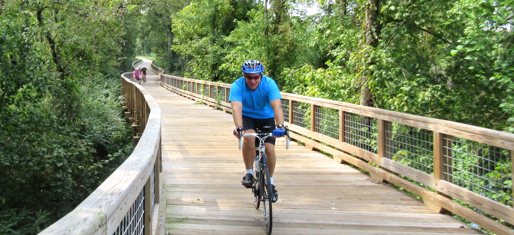
From here, it's smooth sailing, as the bike path is super easy to follow all the way to its terminus at the Chickamauga Dam. (No more distracting art pieces and no more potentially confusing roads & parking lots!) The only thing you'll need to watch out for now is the wooden boardwalk sections. These all come in the next mile, and they can be treacherous with even the slightest bit of moisture. So use extreme caution on the boardwalks in wet conditions.
Other than the potential danger with the boardwalks, this is a nice section of the Riverwalk that is truly riverside riding. Also take note of the Boathouse restaurant as you pass by. You may want to make a pit stop here on your return trip!
This riverfront section ends about a mile and a half after the Battery Place crossing, and the path turns inland. For the next 2.5 miles you'll ride through a mix of beautiful woods, marshes, and industrial areas. While we can't say much for the industrial complexes, the woods & marshes are great and will have you wondering if you somehow ended up in Florida!
This section of the Riverwalk ends with a photogenic bridge crossing over South Chickamauga Creek. After crossing over the creek, we recommend turning left and following the creek down to the Tennessee River. It's a short detour and offers another nice view of the river.
From the river, retrace your steps back to the bridge and continue on the bike path. Note that shortly after the bridge the path splits. Veer to the left to stay on the Riverwalk. The path to the right is the South Chickamauga Creek Greenway, which is another great bike path that follows the creek rather than the river. Our route will have you heading down that path on the return trip. For now, continue on the Riverwalk towards the dam.
Less than a mile after crossing South Chickamauga Creek, you'll come to a nice riverfront park (with the Hubert Fry Center at its heart), and a mile after that you'll reach the end of the line at the massive Chickamauga Dam!
From here, reverse course and follow the path back to where it splits at South Chickamauga Creek (right before the bridge). This split is a little over 2 miles from the dam. Veer to the left to get on the South Chickamauga Greenway rather than continuing on the Riverwalk path over the bridge.
The greenway will take you under Amnicola Highway and across a really nice steel bridge spanning the creek. There are also some cool wooden boardwalk sections on this stretch of the greenway. You will also quickly notice that the greenway has a few more ups and downs than the Riverwalk!
After passing behind some residential neighborhoods and over another steel bridge, the path will eventually turn into gravel, which is your cue to turn around and retrace your steps back to the Riverwalk. The greenway detour is just under 9 miles total out & back.
Once back on the Riverwalk, follow it all the way back to Blue Goose Hollow (a little less than 6 miles) and continue heading south. This southern section is the latest addition to the Riverwalk and offers a very different experience than the section you just rode.
For starters, it gives you an excellent view of Chattanooga's iconic Lookout Mountain almost the whole way. It also runs through a neat mix of industrial areas, some relatively new and some old and rusted out, offering a unique glimpse into Chattanooga's past as an industrial center. These sections are in stark contrast to the beautiful stretches of riverfront riding. They're also in contrast to the brand new developments popping up in this part of town. These new development are just the beginning of what is forecast to be a complete redevelopment of this entire side of Chattanooga, which will reshape the town and drastically change the character of this ride.
For now though, enjoy the peaceful nature of this ride as it meanders through Chattanooga's past and undeveloped future. For the most part, the ride is easy, with only one hill of any significance. There are a couple of train track crossings to be careful with, and watch out for the concrete seams, especially where the path bends sharply, as they have been known to catch skinny tires every now and then.
The path comes to an end at Saint Elmo Avenue, just past the Wheland Foundry trailhead. If you need some energy for the return trip to Blue Goose Hollow, you can refuel at Trailhead Juice or Crust Pizza, both of which are conveniently located just on the other side of Saint Elmo Avenue from where the trail ends.