59 Miles / 7400 Feet of Climbing
Take on one of the longest and most challenging climbs east of Colorado and be rewarded with breathtaking views and an exhilarating descent!
Potential Route Modifications: The climb up the Cherohala Skyway has numerous scenic overlooks which can be used as endpoints if you want to turn around without doing the entire ascent. Skipping the detour to Bald River Falls (near the end of the ride) will reduce the ride by four miles. Staying on the Skyway all the way back to the finish rather than turning onto River Road will also shave off a little distance.
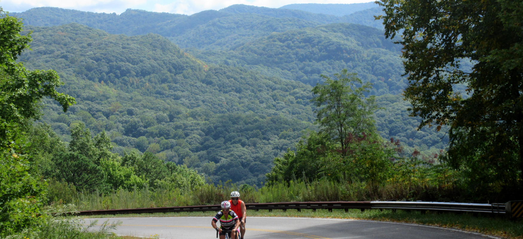
There are few rides east of the Rocky Mountains that offer sustained climbing of this distance - over 20 miles up! And of course, what goes up must come down, which means you'll be treated to a seemingly never-ending descent. Add to the joy of big climbing and descending incredible views and light traffic, and you have one of the best rides in the eastern United States.
To add even more beauty to the ride, we recommend starting the ride on the River Road. Park at the Oosterneck Overlook, which has parking available right next to the Tellico River. By driving to this parking area, you'll avoid riding on the first few miles of the Cherohala Skyway which has a number of blind curves and generally more traffic than the upper elevations. (The Ooseterneck Overlook is 5 miles from the Cherohala Skyway Visitor Center. We recommend stopping at the Visitor Center to get oriented to the Skyway and to take advantage of their restrooms.)
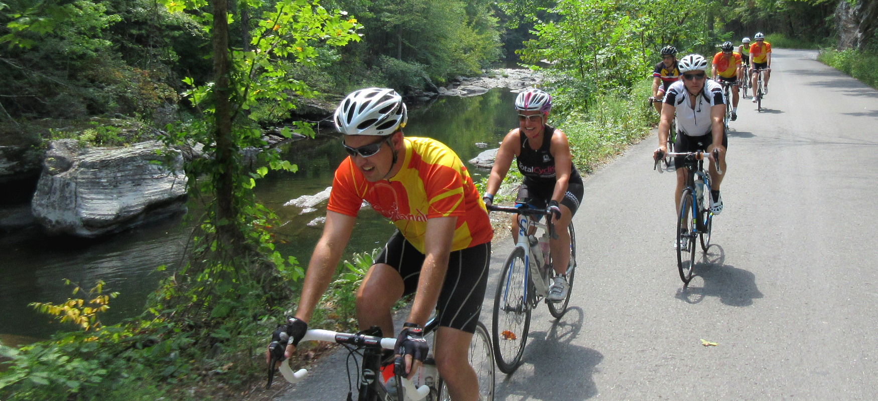
Once you leave the Oosterneck Overlook, you'll immediately take a right onto River Road, which as the name suggests, runs alongside the Tellico River. It's a gorgeous road with a gentle grade which makes it the perfect warm-up for the climbing ahead.
After four miles of blissfully easy riding, you'll take a left onto Turkey Creek Road. Unfortunately this road is unmarked. But there aren't many turns off of River Road, so if you keep an eye on your odometer it will be easy to spot. Plus you'll know you're on the right road because it will be markedly steeper than the River Road! (Be ready to shift down as soon as you make the turn.)
Turkey Creek Road is a rarely used road and is in pretty rough shape, so watch for potholes and rough pavement. In less than a mile, you'll see a steep ramp to the right leading up to the Cherohala Skyway. Go up this ramp and turn right onto the Skyway.
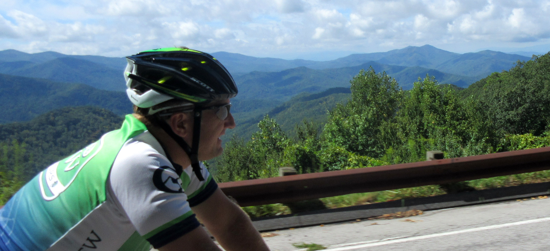
Once on the Skyway, it's time to settle into a comfortable rhythm for the next couple of hours of climbing. The key to long climbs is to set a steady pace with a relaxed heart rate. Focus on the scenery and not the grade and distance. And take advantage of the many overlooks along the way to stop and stretch - and take pictures!
The first viewpoint you'll come to is the Turkey Creek Overlook, which is around mile 12 on the route. There's a restroom here, along with some fantastic views. It will definitely give you a sense of just how high you've already climbed!
The next viewpoint comes only two and half miles later and offers a view off the other side of the Skyway.
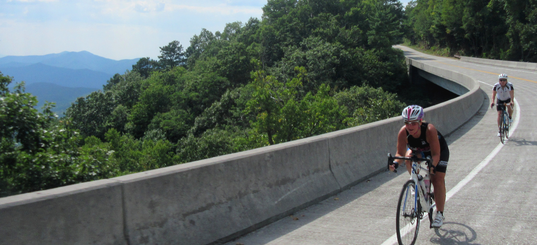
Three miles later you'll come to our favorite overlook (around mile 17.5). Definitely stop for pictures at this one! In addition to the fantastic views, this viewpoint signals a break in the climbing, with a nice downhill just ahead. At the bottom of the downhill, you'll cross a really cool bridge with great views off to your right.
After the bridge the climbing resumes, so be prepared to shift back into your low gears. In fact, this next section is arguably the hardest part of the ride, with grades tipping up for the next couple of miles as you work your way up to the state line.
Other than a sign, there's really no fanfare as you leave Tennessee and enter North Carolina (just before mile 20). It's a little anticlimactic, as there's no view and you're still not at the high point of the Skyway.
The good news is that you'll start to get a few more downhills mixed in with the climbing after crossing the state line. These downhills don't last long, but they are a welcome break from the unrelenting climbing you've been doing. You'll also get some nice views as you ride (rather than having to wait to stop at the overlooks) since you are now running along the top end of the Skyway.
The only disappointing aspect of the Cherohala Skyway is that there isn't a dramatic peak signifying the highpoint of the climb. There is simply a pullout that is generally accepted as the turnaround point for the climb. On the bright side, this parking area (Santeetlah) does have restrooms, which makes it a nice spot to take a break before heading home. (There are also restrooms at the pullout just before mile 22.)
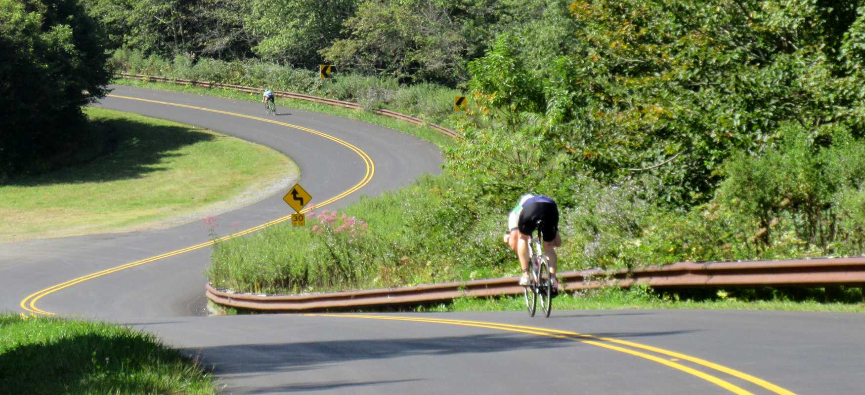
With the exception of a few short climbs, the ride back down the Skyway is pure joy on a seemingly never-ending descent. Keep an eye on the odometer as you start to level out on the lower slopes, as you'll want to turn right off of the Skyway onto Miller Chapel Road just before you reach mile 48.
Shortly after making the turn, Miller Chapel Road "T's" into Turkey Creek Road. Take a left onto Turkey Creek Road and follow it as it makes a short climb and then bends sharply to the left and heads downhill. This downhill is a beautiful tree-lined descent but watch your speed as the road condition is not the best, especially after you roll underneath the Skyway. (This latter portion of the road you may recall from earlier in the ride when it was a bumpy climb up to the Skyway.)
Turkey Creek Road will drop you back down onto River Road. Instead of turning right and heading back down to the ride start, take a left on River Road and follow it a couple of miles to Bald River Falls. As with the start of this ride, the grade on River Road is easy and the views are nice along the river. And once you reach Bald River Falls, you'll understand why we recommend tacking on this detour to the end of the ride.
What makes this waterfall special, in addition to the 90-foot cascade, is that it can be viewed right from the road, perfect for pictures with no hiking required!
After soaking up the waterfall, turn the bikes around and follow the river back down to the ride start at Oosterneck Overlook. It's a gentle downhill ride that makes for a relaxing finish to a solid day of climbing. And if it's a hot day, the Tellico River is a just a few steps away from the Oosterneck parking lot ready to provide a refreshing reset!