46 Miles / 3200 Feet of Climbing
This ride is all about challenge and reward, offering some of the best scenery in the region while serving up a steady dose of climbing - and fast descents!
Potential Route Modifications: This route can be shorted to 24 miles and 1400 feet of climbing by turning north on Reliance Road rather than south at mile 12. You can also change the route to a 15 mile loop by turning right off Steer Creek Road onto 318 at mile 5.4 and then picking up the route heading north on Reliance Road.
We recommend starting this ride in downtown Tellico Plains. There's plenty of parking, and you'll be set up for a great post-ride meal without having to drive anywhere. In addition to a number of restaurants to choose from, historic downtown is a fun place to stroll and shop! The Cherohala Skyway Visitors Center also makes a good place to start (plenty of parking and clean restrooms). You could also run this route in reverse, starting and finishing at the Hiwassee State Scenic River access in Reliance. There's a large parking lot there along with restrooms. And you could grab a post-ride lunch at Flip Flop Burgers just around the corner.
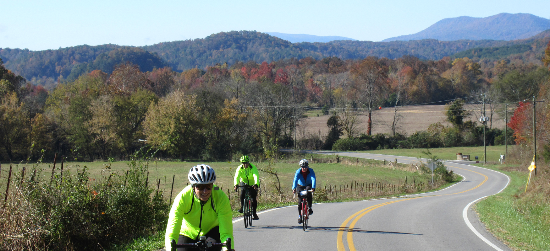
Our route leaves from downtown Tellico Plains and heads south on Scott Street, which is a gradual climb leading up to Hwy 68 (Unicoi Turnpike). This is a busy road, so cross carefully and ride on the wide shoulder on the other side of the road, heading southbound. You'll be on Hwy 68 for about a mile. The last fifth of this stretch is without a shoulder, but it's downhill and before you know it you'll be turning off of the highway onto Steer Creek Road.
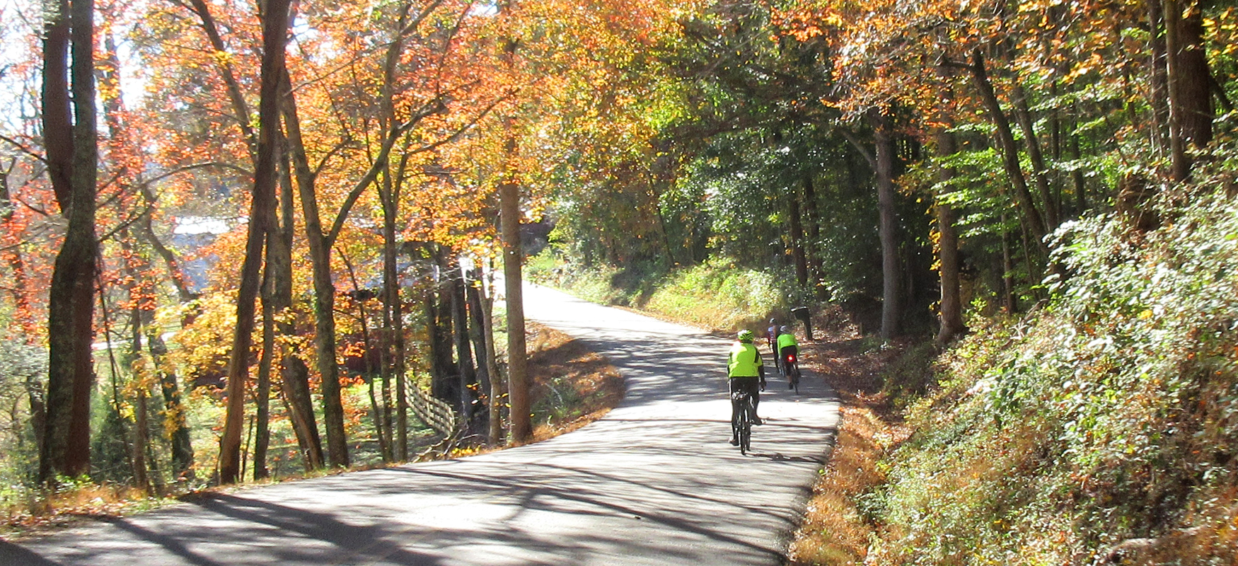
Steer Creek Road is a real treat, starting off with some gorgeous farmland views on your left, and then diving into the deep woods for extended stretches of gorgeous tree-lined riding. You'll definitely do some climbing on this stretch, but it's nothing too steep or intense. This goes on for about six and a half miles before you run into Towee Falls Road where you'll take a right.
Towee Falls Road is a little more punchy than Steer Creek, and it also has more pockets of civilization between the wooded stretches. Some of these backwoods homesteads are nicer than others, and you'll want to keep an eye out for dogs as you pass by. Towee Falls Road finishes with a steep descent down to Reliance Road that you'll want to approach with caution.
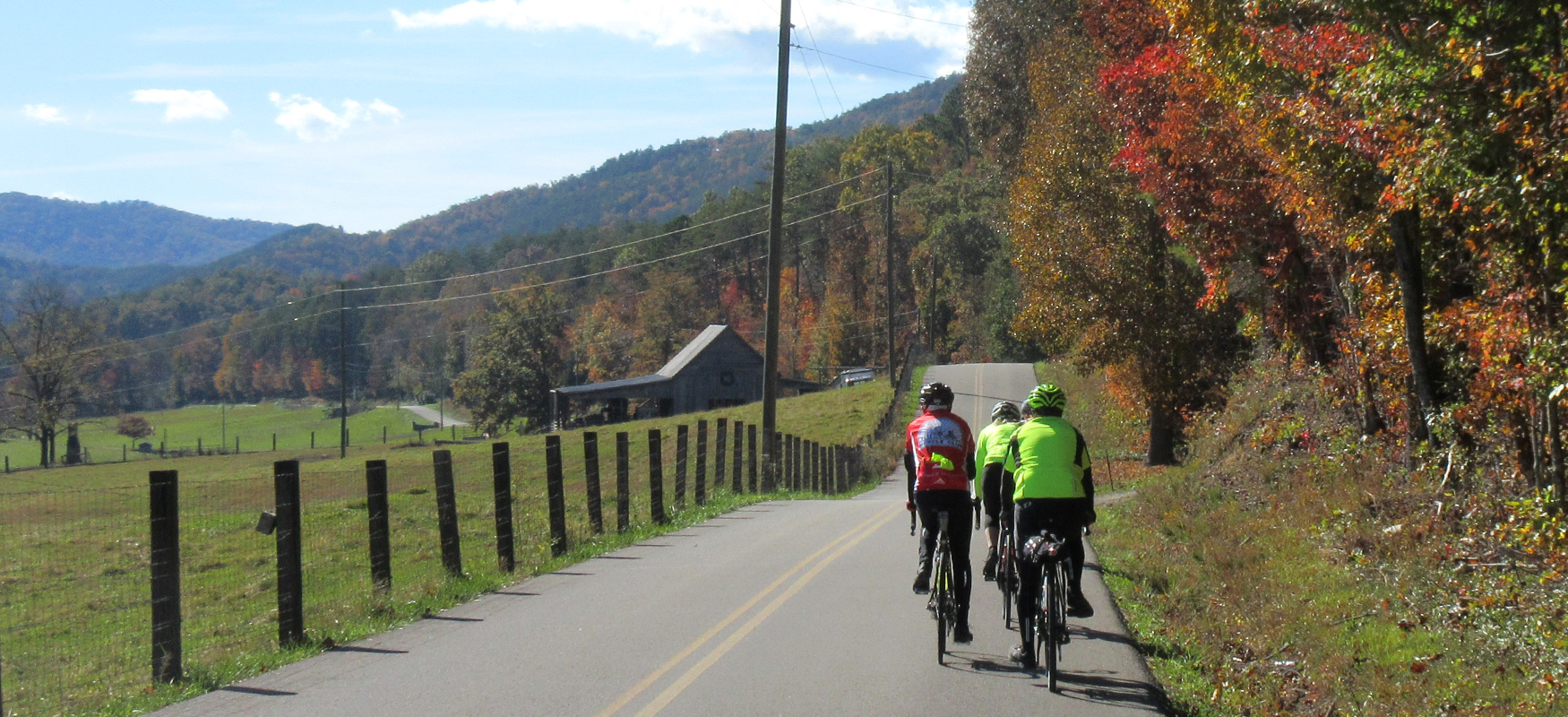
Once you bottom out, take a left on Reliance Road and head south. You'll spend the next 10 miles on Reliance Road, as it rolls along through the woods. Enjoy the smooth pavement and the fun descents, and soak up the scenery as you trudge up the climbs. While traffic shouldn't be an issue, you're more likely to see vehicles on this road than the previous ones, so stay to the right of the road and keep an ear out for cars.
Reliance Road ends with a tough climb followed by an exhilarating descent that will drop you down to the Hiwassee River at high speeds! The bridge across the river offers some spectacular views, and you may consider pausing for a photo if there's no traffic. You should also stop on the other side at Webb Brothers Float Service in the old Texaco building. There's a good view of the river from their parking lot, along with an interpretive kiosk. You can also grab a snack and a drink at their general store, which has been in business since 1936! There are restrooms at the store and also down the road at the Hiwassee State Scenic River access next to Hiwassee Outfitters. And if you need more than a snack, Flip Flop Burgers makes for a great lunch break! (We've included more info about the interesting history of Reliance at the bottom of the page.)
After taking a break at the Hiwassee River, you'll head back on Reliance Road, except this time after crossing the bridge you'll turn right onto Childers Creek Road rather than heading straight on Reliance Road. This will avoid having to go back up the hill you came down on, and it will provide a little change of scenery.
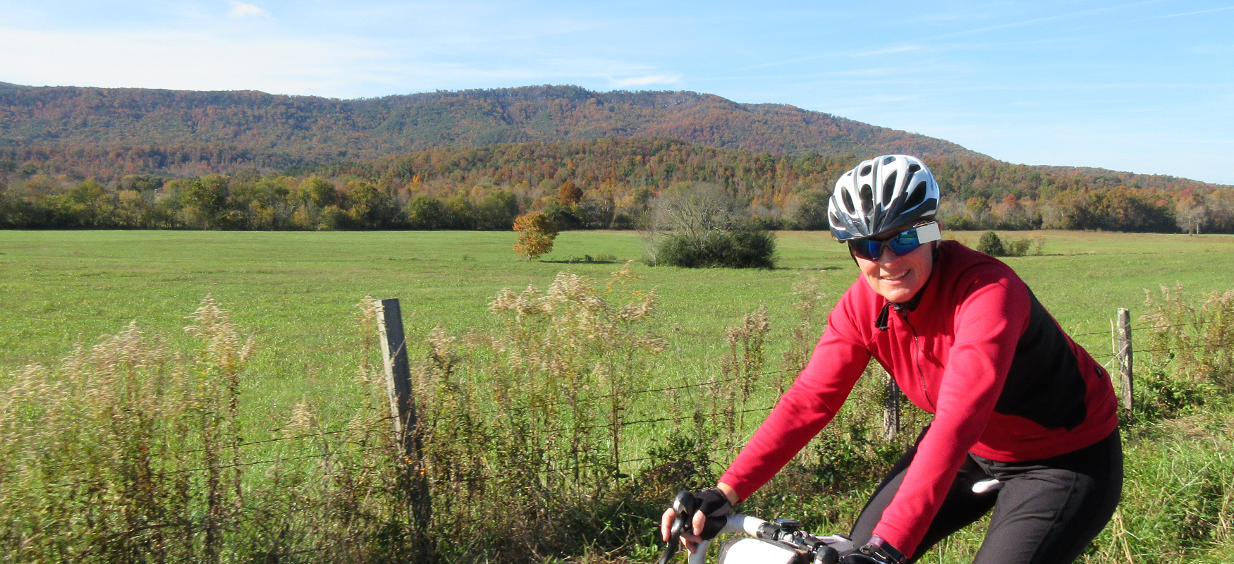
After a little over a mile on Childers Creek, veer left onto Perry Branch Road and follow up it back up to Reliance Road. Once back on Reliance Road, you'll follow it over 13 miles until it T's into Hwy 39. While some of this is repeat scenery rolling through the woods, the last 5 miles will open up into some calendar-worthy views of farmland and mountain backdrop scenery. Have your camera ready!
Just before you get to Hwy 39, look to your left for Cherohala Mountain Trails Campground. This is an excellent place to stay that gives you immediate access to Reliance Road.
Hwy 39 is a very busy road, and you won't want to spend much time on it. So once you take a right onto it coming off of Reliance Road, immediately look to your left for Peels Lane. Turn onto Peels Lane and follow this little farm road as it bends around to the right and runs into Gamble Gap Road. Take a left on Gamble Gap, and, after a mile, turn right onto Dunn Road.
Dunn Road "T's" into Saw Mill Road, where you'll take a right. Turn left (which is more like going straight) onto New Providence Road when you get to the stop sign half a mile later (at the cemetery). Stay to the right as you bend around past the church and New Providence Road will take you over to Hwy 68.
Carefully cross Hwy 68 and follow New Providence Road to Bank Street, where you'll take a right. Bank Street will take you past the Tellicafe restaurant (another option for a post-ride meal) and bring you to the Cherohala Skyway. Be very careful as you take a left here, as you need to look for cars coming from your left and also entering off of Hwy 68 from the right. Use the middle turn lane to help make the turn.
Once you're on the Cherohala Skyway, turn right onto Veterans Memorial Drive to get back to downtown Tellico Plains. You'll see signs pointing you to all the great stuff waiting for you after the ride!
MORE ABOUT RELIANCE:
While Reliance doesn't look like much today, it has an interesting history and was listed in the National Register of Historic Places in 1986. The 1912 bridge has been replaced, but there are still four buildings in the area that were built before the turn of the 20th century: The Watchman’s House, now available for rentals; the Vaughn-Webb house, still a family residence; the Hiwassee Union Church, now available for weddings and special events; and the Higdon Hotel.
Historic stone walls still stand, as does a fish weir used by Cherokee to trap fish. Early farm buildings adorn the corn field. A general store, celebrating its 7th anniversary, offers rafts, tubes and funyaks for fun on the Hiwassee as well as cold drinks, snacks and souvenirs.
The district was listed on the National Register because of its local architectural and historical significance and the fact it represents a significant and distinguishable entity which conveys a sense of time and place.
While settlements were taking hold in other parts of the county and Benton was being developed, the Reliance area was still occupied by the Cherokee. The earliest known settlers of record were T.A. Toomey and D.A. Haskins, who established farms south of the river. Elisha Dodson purchased most of Toomey’s holdings, including a water-powered grist mill and saw mill located near the bridge. This mill, commonly called Dodson’s Mill, ground grain for farmers in the surrounding area and turned freshly-cut logs into lumber and became the center of what would become Reliance.
Dodson’s slave Carol supervised Cherokees who had escaped the Removal in the construction of the stone walls that still stand. Carol also helped build the first mill on the river, cast its wheels, built its rock dam and tended the grinding. When he married Lindy, another slave, Dodson freed them both as a wedding present.
Around 1880, Joseph Dallas Vaughn purchased Dodson’s Mill and other tracts to create the largest and most productive farm in the area. Early settlers relied on farming and timber as their primary sources of income, with the main crops - then as now - being corn and hay.
Reliance was located along a mail route and area mail was left with Sarah Reed Vaughn, whose daughter Alice married into the Webb family, which still owns the family farm.
In the late 19th Century, the arrival of the railroad and river ferry and the location of nearby logging camps helped Reliance develop into a small commercial and social center for the surrounding area. By the early 20th Century, a bridge replaced the ferry as the main form of transportation across the river.
A community building, an early resident’s farm, two buildings associated with the railroad and the bridge combined to form the historic district. All of the historic buildings are of the same material and scale, while the Vaughn-Webb House and Higdon Hotel display interesting sawn wood ornamentation.
The Vaughn-Webb house, located on Hwy 30, was built in the late 1880s. In addition to operating a grist mill, the Vaughn family grew corn and hay, raised cattle, hogs, and mules, and cut timber. Stones from the grist mill can be seen at Webb Brothers Store, and cattle can still be seen in the fields.
The Higdon Hotel was built by Calvin Higdon on the north side of the river after the L&N Railroad purchased right-of-way for track construction in 1888. The large two-story frame hotel with a two-story front porch provided accommodations for the railroad personnel and travelers. It is located on Childer’s Creek Road just a short distance away from the north end of the bridge on Tellico-Reliance Road/315.
The Watchman’s House was built in 1891 for use by the railroad watchman, who checked the railroad bridge for burning embers after the train passed over. It is located just across the bridge.
The Hiwassee Union Church and Masonic Lodge joined forces around 1899 to build a two-story frame building with a full porch across the front. The upper floor was used by the Masons, with the church meeting on the first floor. During the week, the church was used as a school for a short time.
During the first decade of the 20th Century, the forests attracted the attention of large timber companies. The Pendergast Lumber Company built a logging camp called Probst about a mile upriver from Reliance. At its peak, there were more than 25 buildings in Probst. Several families of the workers lived as tenants on the Vaughn-Webb farm. Over the years, several store sites were operated by various tenants on the farm.
Changes took place between 1915 and 1930. The mill burned in 1915, although it was rebuilt and continued to operate into the 1940s. Much of the timber supply was exhausted and the Probst camp closed. With the increasing use of automobiles, fewer passenger trains stopped in Reliance and the hotel ceased to operate around 1920.
The grandsons of Joseph and Sarah Vaughn opened Webb Brothers’ Store on May 15, 1936 to serve as general store, post office, gas station and library. Still in existence, it is now housed in a 1955 building. The mill was demolished in the 1950s, and both the church and Masons ceased using the 1899 building in the 1960s.
In 1969, a whitewater rafting service was begun by the Webb family, bringing a new era of activity to the community, which still retains its historic character.