43 Miles / 2300 Feet of Climbing
Experience in one ride the wonderful diversity - both scenery and topography - that makes Three Rivers Way such a great place to ride!
Potential Route Modifications: There are plenty of ways to shorten this route: Skipping the Dollar General rest stop will shave off 3 miles. Taking a left on Pinhook Road/Co Rd 214 instead of a right will reduce the overall distance by roughly 8 miles. You can also make this route into a 12 mile loop (with 900 feet of climbing) by continuing straight on Clearwater-Rogers Creek Road/Co Rd 180 at mile 4.7 instead of turning right onto Valley Road/Co Rd 187.
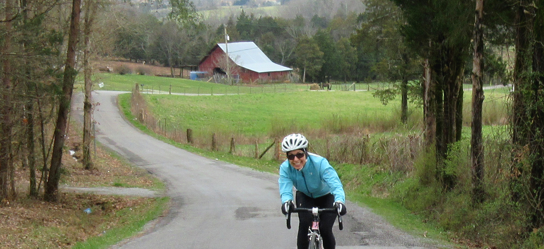
This ride epitomizes what we love about Three Rivers Way. It gives you everything you want in a scenic ride, from wide-open farmland to curvy streamside rollers to legitimate climbs and fast descents. And it even has a perfectly placed convenience store halfway through!
From the Cracker Barrel parking lot, carefully work your way past the Speedway gas station and onto the shoulder of Hwy 30 until you reach Old Decatur Pike/Co Rd 119. (Most of the roads on this route are identified by their county numbers rather than their street names, so we will use both to identify them.)
After turning right onto Co Rd 119, you'll launch into your first hill, a one-mile climb guaranteed to warm up the legs! Fortunately the grade stays fairly consistent (around 7%) and a steady rhythm will have you at the top in no time. Once you crest the hill, take a right onto Shoe Shop Road/Co Rd 168 and enjoy a fast descent down through the trees and into pastoral farmland.
Shoe Shop Road "T's" into Clearwater-Rogers Creek Road/Co Rd 180 where you'll take a left and start the ascent up your second major hill of the day. The grade starts off gently at first but the last quarter-mile tilts up sharply and will have you tackling grades in the low teens! The reward for your hard work is a fun and beautiful tree-lined descent along a little stream that takes you all the way to your next turn at Valley Road/Co Rd 187.
As the name suggests, after turning right onto Valley Road you'll be treated to a beautiful ride through wide-open farmland. (Take a left when you reach the intersection in half a mile to stay on Valley Road.) The road gradually becomes more wooded and more populated as you ride north until you reach Clearwater Road/Co Rd 218 where you'll take a right.
Follow Clearwater Road straight across Co Rd 305, passing through a beautiful farm until you reach Pinhook Road/Co Rd 214. Pinhook Road is a narrow little road, and after you turn right onto it you'll be taken away from the farms and into the backwoods. It's a great road but it does have a few rough patches of pavement. It also has some punchy climbs!
After a couple of miles, veer right onto Nunley Circle. There's no street sign here, but just continue straight rather than turning left and you'll be on Nunley. (To stay on Pinhook Road you have to take a left.) Nunley Circle will take you through a beautiful little cove before bringing you back to Pinhook Road. (Simply continue straight to rejoin Pinhook Road.)
Less than a mile later, Pinhook Road ends with a "T" intersection at Mt Verd Road/Co Rd 250. While not heavily trafficked, this road has the potential for faster vehicles than the backroads you've been riding, so use caution as you turn left onto this road. In just under a mile you'll turn right onto Richeson Road/Co Rd 280.
Richeson Road rolls through some large lot properties for a couple of miles before coming to a "T" intersection at Rockview Church Road/Co Rd 279, where you'll turn left. While Rockview Church Road does have the potential for faster moving traffic, it also has the benefit of smooth pavement. It trends downhill following Little Sewee Creek, and the combination of the smooth pavement and downhill grade makes for a fun ride!
After crossing straight across Mt Verd/Co Rd 250, Rockview Church Road changes names to Co Rd 224 and becomes narrow and a little bumpier. But the remote feel of the road is well worth the loss of smooth pavement. It's a beautiful stretch of road that will have you feeling well removed from civilization.
When you reach the intersection with Collins Road/Co Rd 225, you have the choice of heading into even more remote territory or playing it safe and taking a left onto Collins Road and staying on a paved surface. Continuing straight on Co Rd 224 is a gorgeous way to go as it heads into the woods following Little Sewee Creek, but the pavement is rough to begin with and then disappears altogether for the last half mile. The dirt and gravel is rideable on skinny tires, but if you're uncomfortable with off-road riding, stick to the way we've designed the route and take a left on Collins Road.
While not as rustic and remote as Co Rd 224, Collins Road is still a great road, taking you through rural farmland for a mile and a half before intersecting with Old Clearwater Road/Co Rd 229, where you'll turn right. As you might expect, the return to a road with a double yellow line means the potential for cars, so keep an eye out for passing vehicles on Old Clearwater Road (although we would hardly characterize this road as "busy").
A mile later Old Clearwater Road runs into TN 305, which we would definitely characterize as a busy road. Fortunately, it has a nice shoulder, which you'll use to ride a half-mile up the road to Clearwater Road, where you'll turn right.
Clearwater Road runs somewhat parallel to TN 305 for about a mile before dumping you out at the intersection of TN 305 & Hwy 68. From here, you'll ride the shoulder a quarter mile to the Dollar General for a well-deserved pit stop. In addition to snacks & drinks, the Dollar General has clean restrooms. (Just ask the cashier for the key.)
After the break, continue on the shoulder of Hwy 68 for just under half a mile until you reach Thomas Bivens Road. Turn right on Thomas Bivens Road and follow it back to Clearwater Road, where you can retrace your path back to TN 305. After crossing to the other side of TN 305, ride the shoulder for a 10th of a mile and turn right onto Nopone Valley Road.
Nopone Valley Road is a great ride with sweeping views of open farmland. It's also a lot of fun because, after the initial hill, it has a gentle downhill slope which is a great way to get the legs going again after the rest stop.
After three miles on Nopone Valley Road it turns sharply to the left. Watch for this turn because there's no street sign and it's very easy to just keep going straight (onto Pisgah Academy Road). Once you make this left, the character of the road changes (a little bumpier) as does the scenery (a little more woodsy).
Just before you reach mile 32, veer left onto Sam Davis Road/Co Rd 412 and stay left as it merges with Walker Road less than a half mile later. Sam Davis Road follows a little creek into the woods on a gradual uphill climb. About halfway up the climb (at mile 32.7) turn right onto Sims Road/Co Rd 414.
Sims Road continues the uphill journey along the creek, culminating in a steep finish and an even steeper downhill on the other side. Use caution on this descent as there tends to be loose gravel as the road heads down to Small Cave Road/Co Rd 181.
Take a left onto Small Cave Road and enjoy the rollers for the next two and half miles over to Clearwater-Rogers Creek Road/Co Rd 180. Small Cave Road has a yellow line, which means watch for traffic, and Clearwater-Rogers Creek Road provides access to Hwy 30, which means it will definitely have some vehicular traffic. Neither road is terribly busy, but unlike most of the backroads on this route, you may encounter a few vehicles.
After turning right on Clearwater-Rogers Creek Road, you'll roll a mile and a half down to Hwy 30. This is a major four-lane highway, which can be intimidating when you come to it. Fortunately it has an island in the middle. So carefully cross the first two lanes to the island and then proceed across the next two lanes and continue straight another 10th of a mile until you reach Co Rd 119.
Take a left on Co Rd 119 and keep an eye out for passing vehicles. (Co Rd 119 actually has a small shoulder that you can use. It's bumpy so you won't want to ride on it the whole time, but if you hear a car behind you, you can hop on it temporarily to let them pass.) You'll be on Co Rd 119 for two miles, with almost a mile of it going uphill. It's a great climb, with lots of shade and a steady 7% grade.
After descending down the other side of the hill, look for Spring Creek Valley Road/Co Rd 110 on the right (at mile 40.5). Turn right, and then immediately turn left onto Old Decatur Road/Co Rd 126. This will launch you onto another great climb. Like the previous climb, this one will continue for about a mile with plenty of shade and a steady 6% grade.
However, unlike the previous climb, this one actually has a view at the top, looking east to the Southern Blue Ridge mountains and the Cherokee National Forest. So take a moment to soak up the view before bombing down the hill. Once you start the descent, you're home free, as it's pretty much downhill all the way to your post-ride meal at the Cracker Barrel!